| Łutownia | |
|---|---|
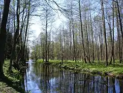 Łutownia River at Dęby Królewskie (Royal Oaks) | |
| Location | |
| Country | Poland |
| Physical characteristics | |
| Source | |
| • location | Nowosady |
| Mouth | |
• location | at Stara Białowieża on the Narewka |
• coordinates | 52°44′34″N 23°49′00″E / 52.7427°N 23.8167°E |
| Length | 19.19 kilometres (11.92 mi) |
| Basin size | 120.44 square kilometres (46.50 sq mi) |
| Basin features | |
| Progression | Narewka→ Narew→ Vistula→ Baltic Sea |
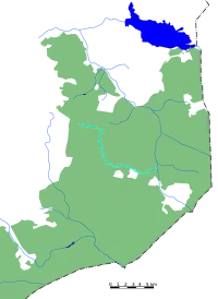
Łutownia River on map of Białowieża Forest
The Łutownia (Polish pronunciation: [wuˈtɔvɲa]; Belarusian: Лутоўня), in northeast Poland, is a left-bank tributary of the Narewka River. It was formerly known in Polish as the Łętownia [wɛnˈtɔvɲa], Lętownia [lɛnˈtɔvɲa], Łotownia [wɔˈtɔvɲa], Łutownica [wutɔvˈnit͡sa], Latownica [latɔvˈnit͡sa], Lutownia [luˈtɔvɲa], and Szczekotówka [ʂt͡ʂɛkɔˈtufka] River.
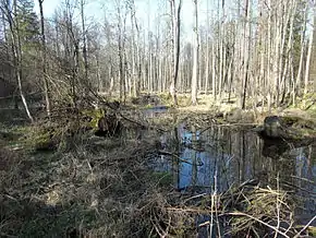
The Łutownia flows through the European region known as the Wysoczyzny Podlasko – Bialoruskie (Podlasie-Belarus Plateau) in Poland's Podlasie Province and Belarus' Hrodna Voblast. The river, from its origin to its mouth, flows through the Białowieża Forest.
Villages:
Main tributaries (right bank):
- Dubinka
- Krynica
Further reading
- P. Bajko, Łutownia, Czasopis, 03/2008, ss. 21–22.
External links
Wikimedia Commons has media related to Łutownia.
- Encyklopedia Puszczy Białowieskiej
- Collection of 30 photographs of the river Łutownia
- E. Pierzgalski, J. Tyszka, A. Stolarek, Zmienność odpływu wody ze zlewni rzeki Łutowni (Puszcza Białowieska) w latach 1966-2000, Leśne Prace Badawcze, 2006, 1:21-36
This article is issued from Wikipedia. The text is licensed under Creative Commons - Attribution - Sharealike. Additional terms may apply for the media files.