Achterhoek | |
|---|---|
Hamlet | |
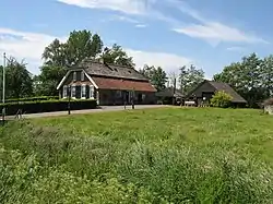 Farm in Achterhoek | |
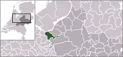 | |
 Achterhoek in the municipality of Nijkerk. | |
| Coordinates: 52°13′15″N 5°24′28″E / 52.22083°N 5.40778°E | |
| Country | Netherlands |
| Province | Gelderland |
| Municipality | Nijkerk |
| Area | |
| • Total | 5.83 km2 (2.25 sq mi) |
| Population (2021)[1] | |
| • Total | 240 |
| • Density | 41/km2 (110/sq mi) |
| Time zone | UTC+1 (CET) |
| • Summer (DST) | UTC+2 (CEST) |
| Postal code | 3861[1] |
| Dialing code | 033 |
Achterhoek (Dutch pronunciation: [ˈɑxtərˌɦuk]) is a hamlet in the Dutch province of Gelderland. It is a part of the municipality of Nijkerk, and lies about 6 km north of Amersfoort.[2]
It was first mentioned in 1608 as "in den Achterhoeck", and means "far away corner".[3] The postal authorities have placed it under Nijkerk.[4] It has no place name signs. In 1840, Achterhoek and De Veenhuis had a combined population of 190 people. Nowadays, Achterhoek consists of about 30 houses.[5]
References
- 1 2 3 "Kerncijfers wijken en buurten 2021". Central Bureau of Statistics. Retrieved 23 March 2022.
Combined listing with De Veenhuis
- ↑ ANWB Topografische Atlas Nederland, Topografische Dienst and ANWB, 2005.
- ↑ "Achterhoek - (geografische naam)". Etymologiebank (in Dutch). Retrieved 23 March 2022.
- ↑ "Postcode 3861 in Nijkerk". Postcode bij adres (in Dutch). Retrieved 23 March 2022.
- ↑ "Achterhoek (Nijkerk)". Plaatsengids (in Dutch). Retrieved 23 March 2022.
This article is issued from Wikipedia. The text is licensed under Creative Commons - Attribution - Sharealike. Additional terms may apply for the media files.