| Ahr | |
|---|---|
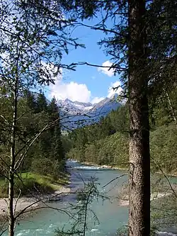 Ahr between Luttach and Sand in Taufers | |
| Location | |
| Country | Italy |
| Physical characteristics | |
| Source | |
| • location | Below the Birnlücke pass, South Tyrol, Italy |
| • coordinates | 47°4′36″N 12°12′29″E / 47.07667°N 12.20806°E |
| Mouth | Rienz |
• location | near Bruneck, South Tyrol, Italy |
• coordinates | 46°47′36″N 11°55′22″E / 46.79333°N 11.92278°E |
• elevation | 815 m (2,674 ft) |
| Length | 50.3 km (31.3 mi) |
| Basin size | 629 km2 (243 sq mi) |
| Basin features | |
| Progression | Rienz→ Eisack→ Adige→ Adriatic Sea |
| Tributaries | |
| • left | Reinbach |
The Ahr (Italian: Aurino [auˈriːno]) is a river in South Tyrol, Italy, which flows through the Tauferer Ahrntal.
References
External links
 Media related to Ahr at Wikimedia Commons
This article is issued from Wikipedia. The text is licensed under Creative Commons - Attribution - Sharealike. Additional terms may apply for the media files.