Alta Floresta d'Oeste | |
|---|---|
 Flag  Coat of arms | |
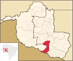 Location in Rondônia state | |
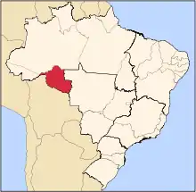
 Alta Floresta d'Oeste Location in Brazil | |
| Coordinates: 11°58′5″S 61°57′15″W / 11.96806°S 61.95417°W | |
| Country | Brazil |
| Region | North |
| State | Rondônia |
| Area | |
| • Total | 7,067 km2 (2,729 sq mi) |
| Population (2020 [1]) | |
| • Total | 22,728 |
| • Density | 3.2/km2 (8.3/sq mi) |
| Time zone | UTC−4 (AMT) |
Alta Floresta d'Oeste is a municipality located in the Brazilian state of Rondônia. Its population was 22,728 (2020) and its area is 7,067 km².[2]
It holds part of the 615,771 hectares (1,521,600 acres) Guaporé Biological Reserve, a strictly protected conservation unit.[3]
References
Capital: Porto Velho | ||||||||
| Porto Velho |
|  | ||||||
| Ji-Paraná |
| |||||||
This article is issued from Wikipedia. The text is licensed under Creative Commons - Attribution - Sharealike. Additional terms may apply for the media files.