Kao Liao
เก้าเลี้ยว | |
|---|---|
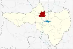 District location in Nakhon Sawan province | |
| Coordinates: 15°51′1″N 100°4′43″E / 15.85028°N 100.07861°E | |
| Country | Thailand |
| Province | Nakhon Sawan |
| Seat | Kao Liao |
| Area | |
| • Total | 256.73 km2 (99.12 sq mi) |
| Population (2013) | |
| • Total | 34,852 |
| • Density | 140/km2 (350/sq mi) |
| Time zone | UTC+7 (ICT) |
| Postal code | 60230 |
| Geocode | 6006 |
Kao Liao (Thai: เก้าเลี้ยว, pronounced [kâːw lía̯w]) is a district (amphoe) of Nakhon Sawan province, central Thailand.
History
The minor district (king amphoe) was created on 1 October 1969, when five tambons were split off from Banphot Phisai district.[1] It was upgraded to a full district on 28 June 1973.[2]
Geography
Neighboring districts are (from the north clockwise): Banphot Phisai of Nakhon Sawan Province; Pho Thale of Phichit province; Chum Saeng and Mueang Nakhon Sawan of Nakhon Sawan.
Administration
The district is divided into five sub-districts (tambons), which are further subdivided into 44 villages (mubans). Kao Liao is a township (thesaban tambon) which covers the whole tambon Kao Liao. There are a further four tambon administrative organizations (TAO).
| No. | Name | Thai name | Villages | Pop. |
|---|---|---|---|---|
| 1. | Maha Phot | มหาโพธิ | 5 | 5,986 |
| 2. | Kao Liao | เก้าเลี้ยว | 5 | 4,988 |
| 3. | Nong Tao | หนองเต่า | 10 | 6,922 |
| 4. | Khao Din | เขาดิน | 12 | 7,149 |
| 5. | Hua Dong | หัวดง | 12 | 9,798 |
References
- ↑ ประกาศกระทรวงมหาดไทย เรื่อง แบ่งท้องที่ตั้งเป็นกิ่งอำเภอ (PDF). Royal Gazette (in Thai). 86 (87 ง): 1020. October 7, 1969. Archived from the original (PDF) on March 24, 2012.
- ↑ พระราชกฤษฎีกาตั้งอำเภอเขาพนม อำเภอสนามชัยเขต อำเภอแม่อาย อำเภอขามสะแกแสง อำเภอเก้าเลี้ยว อำเภอโพธิ์ประทับช้าง อำเภอหนองพอก อำเภอละอุ่น อำเภอทุ่งหว้า และอำเภอศรีธาตุ พ.ศ. ๒๕๑๖ (PDF). Royal Gazette (in Thai). 90 (75 ก special): 32–36. June 28, 1973. Archived from the original (PDF) on February 24, 2012.
External links
This article is issued from Wikipedia. The text is licensed under Creative Commons - Attribution - Sharealike. Additional terms may apply for the media files.