| Attert | |
|---|---|
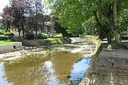 The Attert in Useldange | |
 | |
| Location | |
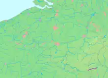
| Country | Belgium, Luxembourg |
| Physical characteristics | |
| Source | |
| • location | Thiaumont, Attert |
| • elevation | 406 m (1,332 ft) |
| Mouth | |
• location | Colmar-Berg |
• coordinates | 49°48′54″N 6°05′46″E / 49.814933°N 6.09612°E |
| Length | 38 km (24 mi) |
| Basin size | 299 km2 (115 sq mi) |
| Basin features | |
| Progression | Alzette→ Sauer→ Moselle→ Rhine→ North Sea |
The Attert (French pronunciation: [atɛʁt], German pronunciation: [ˈatɐt]; Luxembourgish: Atert) is a river flowing through Belgium and Luxembourg, left tributary of the Alzette. Its length is 38 kilometres (24 mi), of which 32 kilometres (20 mi) are in Luxembourg and 6 kilometres (4 mi) in Belgium. Its source is in Nobressart, north-west of Arlon, in the Belgian province Luxembourg. It flows into the river Alzette at Colmar-Berg. It flows through the village of Attert in Belgium, and the towns of Redange, Useldange, Boevange-sur-Attert, and Bissen in Luxembourg.
Wikimedia Commons has media related to Attert River.
This article is issued from Wikipedia. The text is licensed under Creative Commons - Attribution - Sharealike. Additional terms may apply for the media files.