Bő | |
|---|---|
 | |
 Flag  Coat of arms | |
 Bő Location of Bő | |
| Coordinates: 47°22′07″N 16°48′59″E / 47.36853°N 16.81646°E | |
| Country | |
| Region | Western Transdanubia |
| County | Vas |
| District | Sárvár |
| Area | |
| • Total | 10.66 km2 (4.12 sq mi) |
| Population (2004) | |
| • Total | 679 |
| • Density | 63.69/km2 (165.0/sq mi) |
| Time zone | UTC+1 (CET) |
| • Summer (DST) | UTC+2 (CEST) |
| Postal code | 9625 |
| Area code | 94 |
| Website | http://www.bo.hu |
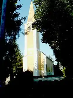
Bő is a village in Sárvár District of Vas County, Hungary with a population of 679 (2004). It covers an area of 10.66 km2.
External links
- Street map (in Hungarian)
This article is issued from Wikipedia. The text is licensed under Creative Commons - Attribution - Sharealike. Additional terms may apply for the media files.