Bonaventure | |
|---|---|
 | |
| Coordinates: 48°03′N 65°29′W / 48.050°N 65.483°W[1] | |
| Country | |
| Province | |
| Region | Gaspésie–Îles-de-la-Madeleine |
| Effective | April 8, 1981 |
| County seat | New Carlisle |
| Government | |
| • Type | Prefecture |
| • Prefect | Jean-Guy Poirier |
| Area | |
| • Total | 4,401.70 km2 (1,699.51 sq mi) |
| • Land | 4,379.40 km2 (1,690.90 sq mi) |
| Population (2016)[3] | |
| • Total | 17,660 |
| • Density | 4.0/km2 (10/sq mi) |
| • Change 2011-2016 | |
| • Dwellings | 8,744 |
| Time zone | UTC−5 (EST) |
| • Summer (DST) | UTC−4 (EDT) |
| Area codes | 418 and 581 |
| Website | www |
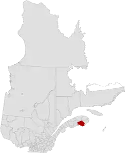
Bonaventure is a regional county municipality in the Gaspésie–Îles-de-la-Madeleine region of eastern Quebec, Canada, on the Gaspé Peninsula. Its seat is New Carlisle.[2]
Subdivisions
There are 14 subdivisions within the RCM:[2]
|
|
|
|
|
Demographics
Population
Canada census – Bonaventure community profile
| 2021 | 2016 | 2011 | |
|---|---|---|---|
| Population | 17,557 (-0.6% from 2016) | 17,660 (-1.9% from 2011) | 18,000 (+0.3% from 2006) |
| Land area | 4,379.46 km2 (1,690.92 sq mi) | 4,379.40 km2 (1,690.90 sq mi) | 4,375.27 km2 (1,689.30 sq mi) |
| Population density | 4/km2 (10/sq mi) | 4.0/km2 (10/sq mi) | 4.1/km2 (11/sq mi) |
| Median age | 53.6 (M: 52.4, F: 54.4) | 52.3 (M: 51.5, F: 52.9) | 50.1 (M: 49.4, F: 50.7) |
| Private dwellings | 8,831 (total) 8,194 (occupied) | 8,744 (total) | 8,525 (total) |
| Median household income | $62,400 | $53,346 | $47,827 |
|
| ||||||||||||||||||||||||
| [9][10] | |||||||||||||||||||||||||
Language
| Canada Census Mother Tongue - Bonaventure Regional County Municipality, Quebec[9][3] | ||||||||||||||||||
|---|---|---|---|---|---|---|---|---|---|---|---|---|---|---|---|---|---|---|
| Census | Total | French |
English |
French & English |
Other | |||||||||||||
| Year | Responses | Count | Trend | Pop % | Count | Trend | Pop % | Count | Trend | Pop % | Count | Trend | Pop % | |||||
2016 |
17,445 |
14,700 | 84.3% | 2,515 | 14.4% | 160 | 0.82% | 70 | 0.4% | |||||||||
2011 |
17,755 |
14,915 | 84.00% | 2,645 | 14.90% | 145 | 0.82% | 50 | 0.28% | |||||||||
2006 |
17,730 |
14,665 | 82.71% | 2,795 | 15.76% | 70 | 0.40% | 200 | 1.13% | |||||||||
2001 |
17,995 |
15,170 | 84.30% | 2,525 | 14.03% | 270 | 1.50% | 30 | 0.17% | |||||||||
1996 |
19,410 |
16,470 | n/a | 84.85% | 2,820 | n/a | 14.53% | 105 | n/a | 0.54% | 15 | n/a | 0.08% | |||||
Transportation
Access Routes
Highways and numbered routes that run through the municipality, including external routes that start or finish at the county border:[11]
Attractions
Banc-de-Paspébiac Historical Site
- Banc-de-Paspébiac Historical Site (Paspébiac)
- Bonaventure Airport (Bonaventure)
- Canomore Hydro (Saint-Elzéar)
- Gaspésie Biopark/Acadian Museum of Quebec (Bonaventure)
- Gaspésie British Heritage Centre (New Richmond)
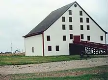
- Hamilton House (1852) (New Carlisle)
- Pin-Rouge Ski Area (New Richmond)
- Saint-Elzéar Cave (Saint-Elzéar)
- St-Edgar Covered Bridge (1938) (New Richmond)
Protected Areas
- Petite-Cascapédia Wildlife Reserve
- Port-Daniel Wildlife Reserve
- MLPC Campaign Post
- Rivière-Bonaventure ZEC
- Rivière-Cascapédia Wildlife Reserve
- Rivière-Port-Daniel Wildlife Reserve
See also
References
- ↑ "Banque de noms de lieux du Québec: Reference number 141115". toponymie.gouv.qc.ca (in French). Commission de toponymie du Québec.
- 1 2 3 4 "Répertoire des municipalités: Geographic code 050". www.mamh.gouv.qc.ca (in French). Ministère des Affaires municipales et de l'Habitation.
- 1 2 3 "Census Profile, 2016 Census: Bonaventure, Municipalité régionale de comté [Census division], Quebec". Statistics Canada. Retrieved November 29, 2019.
- ↑ "2021 Community Profiles". 2021 Canadian Census. Statistics Canada. February 4, 2022. Retrieved 2023-10-19.
- ↑ "2016 Community Profiles". 2016 Canadian Census. Statistics Canada. August 12, 2021. Retrieved 2014-03-09.
- ↑ "2011 Community Profiles". 2011 Canadian Census. Statistics Canada. March 21, 2019. Retrieved 2014-03-09.
- ↑ "2006 Community Profiles". 2006 Canadian Census. Statistics Canada. August 20, 2019.
- ↑ "2001 Community Profiles". 2001 Canadian Census. Statistics Canada. July 18, 2021.
- 1 2 Statistics Canada: 1996, 2001, 2006, 2011 census
- ↑ "Bonaventure Regional County Municipality (Code 2405) Census Profile". 2011 census. Government of Canada - Statistics Canada.
- ↑ Official Transport Quebec Road Map
Adjacent Counties & Equivalent Territories | |
|---|---|
| Regional county municipalities and equivalent territories | |
|---|---|
| Municipalities | |
This article is issued from Wikipedia. The text is licensed under Creative Commons - Attribution - Sharealike. Additional terms may apply for the media files.