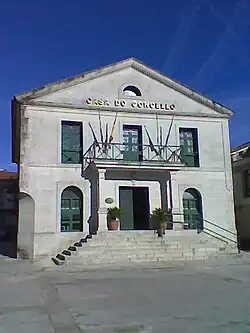
Concello de Cerdedo | |
|---|---|
 | |
 Flag  Seal | |
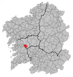 Situation of Cerdedo within Galicia | |
| Coordinates: 42°32′N 8°23.5′W / 42.533°N 8.3917°W | |
| Country | |
| Autonomous community | |
| Province | Pontevedra |
| Parroquias | 8 |
| Government | |
| • Alcalde (Mayor) | Silvestre José Balseiros Guinarte |
| Area | |
| • Total | 79.8 km2 (30.8 sq mi) |
| Population (2012) | |
| • Total | 1,916 |
| • Density | 24/km2 (62/sq mi) |
| (INE) | |
| Time zone | UTC+1 (CET) |
| • Summer (DST) | UTC+2 (CET) |
Cerdedo is a former municipality in Galicia, Spain in the province of Pontevedra.
Location
Located in the region known as Tabeirós - Terra de Montes, bordered to the north by Forcarei and A Estrada, to the west by Cotobade (with which it has since been amalgamated) and Campo Lameiro and to the east by Forcarei.
Demography
|
| |||||||||||||||||||||
| Source: Article in Spanish and Galician | ||||||||||||||||||||||
The population in 2012 was 1,916.
Civil parishes
The municipality is composed of 8 parishes:
- Castro (Santa Baia)
- Cerdedo (San Xoán)
- Figueiroa (San Martiño)
- Folgoso (Santa María)
- Parada (San Pedro)
- Pedre (Santo Estevo)
- Quireza (San Tomé)
- Tomonde (Santa María)
This article is issued from Wikipedia. The text is licensed under Creative Commons - Attribution - Sharealike. Additional terms may apply for the media files.