 | |
|---|---|
| Route information | |
| Length | 3.1 km (1.9 mi) |
| Major junctions | |
| From | |
| To | |
| Location | |
| Country | Croatia |
| Counties | Primorje-Gorski Kotar |
| Major cities | Bakar |
| Highway system | |
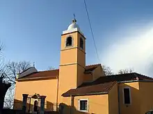
Sveti Kuzam, adjacent to the D40 road
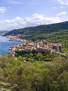
Bakar, immediately to the south of the southern D40 terminus
D40 is a state road connecting A7 motorway at Sveti Kuzam interchange,[1] to D8 state road and to Port of Bakar.[maps 1] The road is 3.1 km (1.9 mi) long.[2]
The road, as well as all other state roads in Croatia, is managed and maintained by Hrvatske ceste, a state owned company.[3]
Road junctions and populated areas
| D40 junctions/populated areas | |
| Type | Slip roads/Notes |
Ž5205 to Škrljevo and Čavle (D3). Northern terminus of the road. | |
| Port of Bakar (West) Southern terminus of the road. | |
Maps
- ↑ Overview map of the D40 (Map). OpenStreetMap. Retrieved August 19, 2014.
Sources
- ↑ "Regulation on motorway markings, chainage, interchange/exit/rest area numbers and names". Narodne novine (in Croatian). May 6, 2003.
- ↑ Ministry of Sea, Transport and Infrastructure (Croatia) (May 10, 2013). "Odluka o razvrstavanju javnih cesta" [Decision on categorization of public roads]. Narodne novine (in Croatian) (66/2013).
- ↑ "Public Roads Act". Narodne novine (in Croatian). December 14, 2004.
This article is issued from Wikipedia. The text is licensed under Creative Commons - Attribution - Sharealike. Additional terms may apply for the media files.