Lot 29, Prince Edward Island | |
|---|---|
Township | |
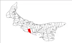 Map of Prince Edward Island highlighting Lot 29 | |
| Coordinates: 46°15′N 63°27′W / 46.250°N 63.450°W | |
| Country | Canada |
| Province | Prince Edward Island |
| County | Queens County |
| Parish | Hillsboro. |
| Area | |
| • Total | 83.65 km2 (32.30 sq mi) |
| Population (2006) | |
| • Total | 935 |
| • Density | 10.3/km2 (27/sq mi) |
| Time zone | UTC-4 (AST) |
| • Summer (DST) | UTC-3 (ADT) |
| Canadian Postal code | C0A |
| Area code | 902 |
| NTS Map | 011L03 |
| GNBC Code | BAERP |
Lot 29 is a township in Queens County, Prince Edward Island, Canada. It is part of Hillsboro Parish. Lot 29 was awarded to Admiral Charles Saunders in the 1767 land lottery.[1]
Communities
Incorporated municipalities:
Civic address communities:
- Argyle Shore
- Crapaud
- DeSable
- Hampton
- Inkerman
- Kellys Cross
- South Melville
- Stanchel
- Westmoreland
- Victoria
References
- ↑ Clark, Andrew Hill (1959). Three Centuries and the Island. Toronto Press. pp. Appendix B.
Subdivisions of Prince Edward Island | |||||||
|---|---|---|---|---|---|---|---|
| Subdivisions | |||||||
| Cities | |||||||
| Towns | |||||||
| Rural municipalities |
| ||||||
| Resort municipalities | |||||||
| Former municipalities |
| ||||||
| Unincorporated communities | |||||||
| Townships | |||||||
| |||||||
This article is issued from Wikipedia. The text is licensed under Creative Commons - Attribution - Sharealike. Additional terms may apply for the media files.