Driehuizen | |
|---|---|
Village | |
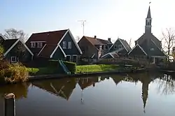 View on Driehuizen from the canal | |
 Driehuizen Location in the Netherlands 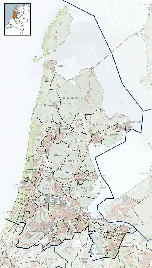 Driehuizen Location in the province of North Holland in the Netherlands | |
| Coordinates: 52°35′N 4°48′E / 52.583°N 4.800°E | |
| Country | Netherlands |
| Province | North Holland |
| Municipality | Alkmaar |
| Area | |
| • Total | 4.47 km2 (1.73 sq mi) |
| Elevation | −2.2 m (−7.2 ft) |
| Population (2021)[1] | |
| • Total | 245 |
| • Density | 55/km2 (140/sq mi) |
| Time zone | UTC+1 (CET) |
| • Summer (DST) | UTC+2 (CEST) |
| Postal code | 1844[1] |
| Dialing code | 0299 |
Driehuizen is a village in the Dutch province of North Holland. It is a part of the municipality of Alkmaar, and lies about 8 km south of the city of Alkmaar. The name literally means Three houses, and was first mentioned in 1639.[3]
Driehuizen developed on the former island of Schermereiland. According to legend, there were three houses in 1603.[4] After the Schermer was poldered in 1635, it received a road connection to Zuidschermer.[4] Driehuizen was home to 156 people in 1840.[5]
The former Dutch Reformed church is an aisleless church with wooden tower which was built in 1912 as a replacement of the 1648 church. It is nowadays used as village house.[4]
Gallery
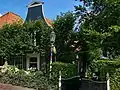 House in Driehuizen
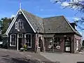 Pub in Driehuizen
References
- 1 2 3 "Kerncijfers wijken en buurten 2021". Central Bureau of Statistics. Retrieved 28 April 2022.
- ↑ "Postcodetool for 1844KA". Actueel Hoogtebestand Nederland (in Dutch). Het Waterschapshuis. Retrieved 28 April 2022.
- ↑ "Driehuizen - (geografische naam)". Etymologiebank (in Dutch). Retrieved 28 April 2022.
- 1 2 3 Ronald Stenvert & Saskia van Ginkel-Meester (2006). "Driehuizen" (in Dutch). Zwolle: Waanders. Retrieved 28 April 2022.
- ↑ "Driehuizen". Plaatsengids (in Dutch). Retrieved 28 April 2022.
This article is issued from Wikipedia. The text is licensed under Creative Commons - Attribution - Sharealike. Additional terms may apply for the media files.