| Feisnecksee | |
|---|---|
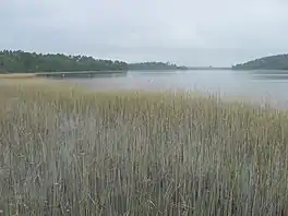 Southern end of the Feisnecksee | |
 Feisnecksee | |
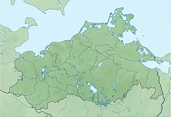
| Location | Mecklenburgische Seenplatte district, Mecklenburg-Vorpommern |
| Coordinates | 53°29′45″N 12°42′28″E / 53.49583°N 12.70778°E |
| Primary inflows | ditches e.g. from the Krummen See, Müritz and Waupacksee |
| Primary outflows | ditch to Lake Müritz |
| Catchment area | 31.9 km2 (12.3 sq mi)[1] |
| Basin countries | Germany |
| Max. length | 3.100 km (1.926 mi)[1] |
| Max. width | 0.600 km (0.373 mi)[1] |
| Surface area | 1.94 km2 (0.75 sq mi)[1] |
| Average depth | 7.5 m (25 ft)[1] |
| Max. depth | 14 m (46 ft)[1] |
| Water volume | 14,570,000 km3 (3,500,000 cu mi)[1] |
| Surface elevation | 62.1 m (204 ft) above NHN |
| Settlements | Waren (Müritz) |

The Feisnecksee or Feisneck is a lake on the southeastern perimeter of the town of Waren in Mecklenburgische Seenplatte district in the German state of Mecklenburg-Western Pomerania. It lies at an elevation of 62.1 metres and its surface area is 1.94 km².
The Feisnecksee is joined to the Binnenmüritz to the northwest by a very narrow, shallow and unnavigable ditch. The road runs over a small bridge here that is only wide enough for large vehicles to pass in one direction at a time. The land bridge is about 150 metres wide at this point. The lake is a typical, glacial tunnel valley lake and is divided by a neck and the larger Burgwall Island into a north and south basins. It is about 3,100 metres long and 600 metres wide. Near the southern half is the Waren quarter of Damerow. The lakeshore is completely surrounded by a belt of reed and is also wooded in the south. In the north half of the lake is a bathing area. Fishing is only allowed by special permit because the lake lies in the national park.
References
External links
- Nixdorf, B.; et al. (2004), "Feisnecksee", Dokumentation von Zustand und Entwicklung der wichtigsten Seen Deutschlands (in German), Berlin: Umweltbundesamt, p. 74