| Schwarzhorn | |
|---|---|
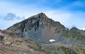 Schwarzhorn from the Fuorcla Radönt | |
| Highest point | |
| Elevation | 3,146 m (10,322 ft) |
| Prominence | 609 m (1,998 ft)[1] |
| Parent peak | Piz Kesch |
| Isolation | 5.55 km (3.45 mi) |
| Listing | Alpine mountains above 3000 m |
| Coordinates | 46°44′6″N 9°56′30″E / 46.73500°N 9.94167°E |
| Naming | |
| Native name | Schwarzhorn (German) |
| Geography | |
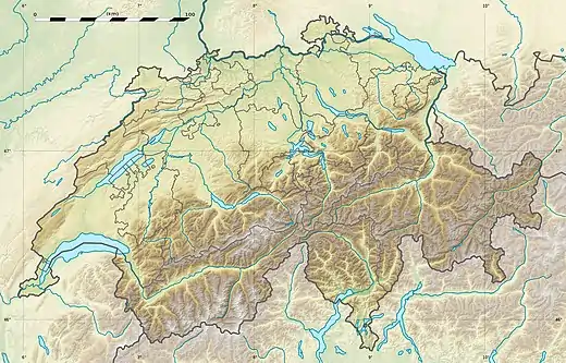 Location in Switzerland | |
| Country | Switzerland |
| Canton | Graubünden |
| Parent range | Albula Alps |
| Topo map | Swisstopo maps |
The Flüela Schwarzhorn is a mountain of the Albula Alps, overlooking the Flüela Pass, in the canton of Graubünden. With a height of 3,146 metres above sea level, it is the highest point of the Albula Alps north of the Fuorcla da Grialetsch (2,537 m). From the Flüela Pass a trail leads to the summit.
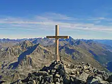
View from the top
References
External links
This article is issued from Wikipedia. The text is licensed under Creative Commons - Attribution - Sharealike. Additional terms may apply for the media files.