Freudenberg | |
|---|---|
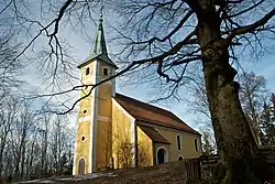 Church of Saint John the Baptist | |
 Flag _COA.svg.png.webp) Coat of arms | |
Location of Freudenberg within Amberg-Sulzbach district 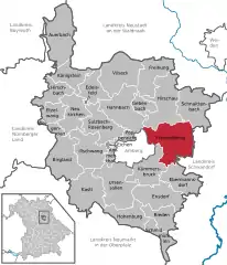 | |
 Freudenberg 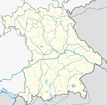 Freudenberg | |
| Coordinates: 49°29′N 11°59′E / 49.483°N 11.983°E | |
| Country | Germany |
| State | Bavaria |
| Admin. region | Oberpfalz |
| District | Amberg-Sulzbach |
| Government | |
| • Mayor (2020–26) | Alwin Märkl[1] (CSU) |
| Area | |
| • Total | 78.81 km2 (30.43 sq mi) |
| Elevation | 470 m (1,540 ft) |
| Population (2022-12-31)[2] | |
| • Total | 4,138 |
| • Density | 53/km2 (140/sq mi) |
| Time zone | UTC+01:00 (CET) |
| • Summer (DST) | UTC+02:00 (CEST) |
| Postal codes | 92272 |
| Dialling codes | 09627 |
| Vehicle registration | AS |
| Website | www.gemeinde-freudenberg.de |
Freudenberg is a municipality in the Amberg-Sulzbach district, in Bavaria, Germany. It is situated approximately 10 km north-east of Amberg.
References
- ↑ Liste der ersten Bürgermeister/Oberbürgermeister in kreisangehörigen Gemeinden, Bayerisches Landesamt für Statistik, 15 July 2021.
- ↑ Genesis Online-Datenbank des Bayerischen Landesamtes für Statistik Tabelle 12411-003r Fortschreibung des Bevölkerungsstandes: Gemeinden, Stichtag (Einwohnerzahlen auf Grundlage des Zensus 2011)
Towns and municipalities in Amberg-Sulzbach | ||
|---|---|---|
| Coat of Arms of Amberg-Sulzbach district | |
This article is issued from Wikipedia. The text is licensed under Creative Commons - Attribution - Sharealike. Additional terms may apply for the media files.