Guang'anmennei Subdistrict
广安门内街道 | |
|---|---|
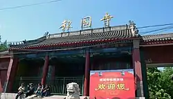 Baoguo Temple within the subdistrict, 2016 | |
 Guang'anmennei Subdistrict  Guang'anmennei Subdistrict | |
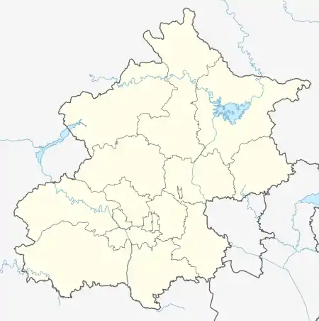
| Coordinates: 39°53′46″N 116°21′55″E / 39.89611°N 116.36528°E | |
| Country | China |
| Municipality | Beijing |
| District | Xicheng |
| Area | |
| • Total | 2.43 km2 (0.94 sq mi) |
| Population (2020) | |
| • Total | 60,318 |
| • Density | 25,000/km2 (64,000/sq mi) |
| Time zone | UTC+8 (China Standard) |
| Postal code | 100053 |
| Area code | 010 |
Guang'anmennei Subdistrict (Chinese: 广安门内街道; pinyin: Guǎng'ānménnèi Jiēdào) is a subdistrict within the southern half of Xicheng District, Beijing, China. As of 2020, it has a total population of 60,318.[1]
The subdistrict got its name due to the fact that it is located within Guang'anmen (Chinese: 广安门; lit. 'Gate of Expansive Peace') and the former Beijing city wall.
History
| Time | Status |
|---|---|
| 938 | Part of Tangyin, Shihe and Xianlu Wards |
| Jin dynasty | Part of Tangyin, Shihe, Xianlu, Huixian, Kaiyuan and Jintai Wards |
| Ming dynasty | Part of South Urban Region |
| Qing dynasty | Part of Right 3rd Outer District |
| 1928 | Part of 4th Outer District |
| 1949 | Part of 11th District |
| 1950 | Part of 8th District |
| 1952 | Part of Xuanwu District |
| 1954 | Four subdistricts were created: Xiaochang Santiao, Guanghuisi, Xiaxiejie and Yingfang |
| 1958 | Merged into Guangnei Subdistrict |
| 1960 | Changed to a commune |
| 1978 | Reinstated as Guang'anmennei Subdistrict |
Administrative Division
As of 2021, there are 18 communities within the subdistrict:[3]
| Administrative Division Code | Community Name (English) | Community Name (Chinese) |
|---|---|---|
| 110102017001 | Xibianmen Xili | 西便门西里 |
| 110102017002 | Xibianmen Dongli | 西便门东里 |
| 110102017003 | Huaiboshujie Beili | 槐柏树街北里 |
| 110102017004 | Changchunjiexi | 长椿街西 |
| 110102017005 | Huaiboshujie Nanli | 槐柏树街南里 |
| 110102017006 | Hetaoyuan | 核桃园 |
| 110102017007 | Baoguosi | 报国寺 |
| 110102017008 | Shangxiejie | 上斜街 |
| 110102017009 | Xuanwumen | 宣武门西大街 |
| 110102017010 | Sanmiaojie | 三庙街 |
| 110102017011 | Kangleli | 康乐里 |
| 110102017012 | Guang'an Dongli | 广安东里 |
| 110102017013 | Dajiedong | 大街东 |
| 110102017014 | Laoqianggen | 老墙根 |
| 110102017015 | Changchunjie | 长椿街 |
| 110102017016 | Xibianmennei | 西便门内 |
| 110102017017 | Changchunli | 长椿里 |
| 110102017018 | Xiaochang | 校场 |
Landmark
External links
References
- ↑ Zhong guo tong ji nian jian = China statistical yearbook. 2020(zong di 39 qi) 2020(No. 39). Guo jia tong ji ju, 国家统计局. (Di 1 ban ed.). Beijing: Zhong guo tong ji chu ban she. 2020. ISBN 978-7-5037-9225-0. OCLC 1262741013.
{{cite book}}: CS1 maint: others (link) - ↑ Zhong hua ren min gong he guo zheng qu da dian. Bei jing shi juan. Li li guo, Li wan jun, Wu shi min, 李立国., 李万钧., 吴世民. Bei jing: Zhong guo she hui chu ban she. 2013. ISBN 978-7-5087-4058-4. OCLC 910451741.
{{cite book}}: CS1 maint: others (link) - ↑ "2021年统计用区划代码和城乡划分代码". www.stats.gov.cn. Retrieved 2022-09-21.
This article is issued from Wikipedia. The text is licensed under Creative Commons - Attribution - Sharealike. Additional terms may apply for the media files.