Hien | |
|---|---|
Hamlet and neighbourhood | |
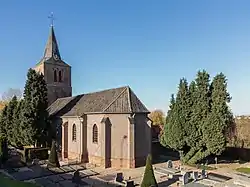 Church of Hien | |
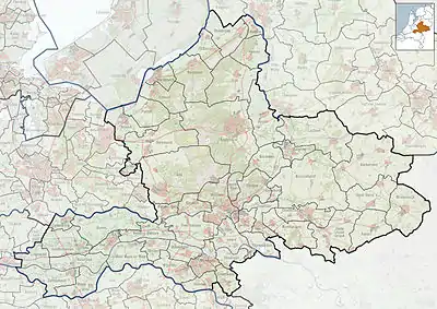 Hien Location in the Netherlands  Hien Hien (Netherlands) | |
| Coordinates: 51°54′29″N 5°39′58″E / 51.90816°N 5.66616°E | |
| Country | Netherlands |
| Province | Gelderland |
| Municipality | Montferland |
| Area | |
| • Total | 1.86 km2 (0.72 sq mi) |
| Elevation | 8 m (26 ft) |
| Population (2021)[1] | |
| • Total | 3,310 |
| • Density | 1,800/km2 (4,600/sq mi) |
| Time zone | UTC+1 (CET) |
| • Summer (DST) | UTC+2 (CEST) |
| Postal code | 6669[1] |
| Dialing code | 0488 |
Hien is a neighbourhood of Dodewaard and a hamlet in the Dutch province of Gelderland. It is located in the municipality of Neder-Betuwe, about 1 km east of Dodewaard.
It was first mentioned in the late 9th century as Hehun. The etymology is unclear.[3] Around 1300, Hien becomes an independent parish. The tower of church burned down in 1641 and was replaced in 1787. In 1842, the church was demolished and replaced by a new church. In 1840, it was home to 637 people. It grew into a single urban area with Dodewaard and most of the original village including the church has been annexed. There are about a dozen houses in the hamlet left.[4]
Gallery
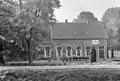 Farm at Hien
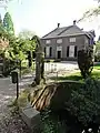 Villa at Hien
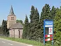 Place name sign of Dodewaard in front of the church of Hien
References
- 1 2 3 "Kerncijfers wijken en buurten 2021". Central Bureau of Statistics. Retrieved 23 March 2022.
together with Dodewaard
- ↑ "Postcodetool for 6669AA". Actueel Hoogtebestand Nederland (in Dutch). Het Waterschapshuis. Retrieved 23 March 2022.
- ↑ "Hien - (geografische naam)". Etymologiebank (in Dutch). Retrieved 23 March 2022.
- ↑ "Hien". Plaatsengids (in Dutch). Retrieved 23 March 2022.
Wikimedia Commons has media related to Hien, Netherlands.
This article is issued from Wikipedia. The text is licensed under Creative Commons - Attribution - Sharealike. Additional terms may apply for the media files.