Keno, Oregon | |
|---|---|
 Keno entrance sign, elementary school in the background. | |
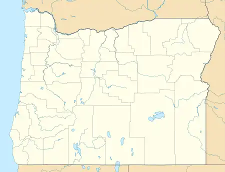 Keno Location within Oregon and the United States  Keno Keno (the United States) | |
| Coordinates: 42°7′36″N 121°55′44″W / 42.12667°N 121.92889°W | |
| Country | United States |
| State | Oregon |
| County | Klamath |
| Area | |
| • Total | 9.57 sq mi (24.79 km2) |
| • Land | 9.25 sq mi (23.96 km2) |
| • Water | 0.32 sq mi (0.82 km2) |
| Elevation | 4,108 ft (1,252 m) |
| Population | |
| • Total | 1,980 |
| • Density | 213.98/sq mi (82.62/km2) |
| Time zone | UTC-8 (Pacific (PST)) |
| • Summer (DST) | UTC-7 (PDT) |
| ZIP code | 97627[3] |
| Area code(s) | 458 and 541 |
| FIPS code | 41-38750 |
Keno is an unincorporated community in Klamath County, Oregon, United States, southwest of Klamath Falls on the Klamath River near Oregon Route 66. As of 2000, the population was 1,059.[4] Keno's elevation is 4,108 feet (1,252 m) above sea level.[5]
Keno was supposedly named after the first postmaster's bird dog. It was previously called Plevna and Whittles Ferry. Keno post office was established in 1887.[6]
One hundred eighty eight children attend Keno's one school, Keno Elementary. It is a K–6 school in the Klamath County School District.[7]
Demographics
| Census | Pop. | Note | %± |
|---|---|---|---|
| 2020 | 1,980 | — | |
| U.S. Decennial Census[8][2] | |||
Climate
This region experiences warm (but not hot) and dry summers, with no average monthly temperatures above 85 °F (29 °C). According to the Köppen Climate Classification system, Keno has a dry-summer humid continental climate, abbreviated "Dsb" on climate maps.
| Climate data for Keno, OR | |||||||||||||
|---|---|---|---|---|---|---|---|---|---|---|---|---|---|
| Month | Jan | Feb | Mar | Apr | May | Jun | Jul | Aug | Sep | Oct | Nov | Dec | Year |
| Record high °F (°C) | 58 (14) |
62 (17) |
65 (18) |
81 (27) |
85 (29) |
94 (34) |
97 (36) |
99 (37) |
92 (33) |
86 (30) |
61 (16) |
55 (13) |
99 (37) |
| Mean daily maximum °F (°C) | 38.5 (3.6) |
42.6 (5.9) |
45.7 (7.6) |
53.6 (12.0) |
64.5 (18.1) |
74.5 (23.6) |
83.3 (28.5) |
85.1 (29.5) |
83.8 (28.8) |
67 (19) |
44.9 (7.2) |
37.8 (3.2) |
60.1 (15.6) |
| Mean daily minimum °F (°C) | 20 (−7) |
21.2 (−6.0) |
26.1 (−3.3) |
27.5 (−2.5) |
33.3 (0.7) |
41.3 (5.2) |
46.9 (8.3) |
46.2 (7.9) |
40.7 (4.8) |
31.4 (−0.3) |
27.1 (−2.7) |
16 (−9) |
31.5 (−0.3) |
| Record low °F (°C) | −7 (−22) |
−6 (−21) |
1 (−17) |
14 (−10) |
21 (−6) |
26 (−3) |
30 (−1) |
34 (1) |
33 (1) |
19 (−7) |
11 (−12) |
−1 (−18) |
−7 (−22) |
| Average precipitation inches (mm) | 2.84 (72) |
1.99 (51) |
1.92 (49) |
1.28 (33) |
1.21 (31) |
0.88 (22) |
0.34 (8.6) |
0.45 (11) |
0.63 (16) |
1.5 (38) |
2.59 (66) |
3.21 (82) |
18.84 (479) |
| Average snowfall inches (cm) | 16 (41) |
9.9 (25) |
6.5 (17) |
2.1 (5.3) |
0.2 (0.51) |
0 (0) |
0 (0) |
0 (0) |
0 (0) |
0.5 (1.3) |
6.4 (16) |
13.5 (34) |
55 (140) |
| Average precipitation days | 12 | 10 | 11 | 9 | 7 | 5 | 2 | 2 | 3 | 6 | 11 | 12 | 90 |
| Source: [9] | |||||||||||||
References
- ↑ "ArcGIS REST Services Directory". United States Census Bureau. Retrieved October 12, 2022.
- 1 2 "Census Population API". United States Census Bureau. Retrieved October 12, 2022.
- ↑ "Keno OR ZIP Code". zipdatamaps.com. 2023. Retrieved June 16, 2023.
- ↑ City Data
- ↑ Epodunk
- ↑ McArthur, Lewis A.; Lewis L. McArthur (2003) [1928]. Oregon Geographic Names (Seventh ed.). Portland, Oregon: Oregon Historical Society Press. pp. 529–530. ISBN 0-87595-277-1.
- ↑ Klamath County School District
- ↑ "Census of Population and Housing". Census.gov. Retrieved June 4, 2016.
- ↑ "KENO, OR (354403)". Western Regional Climate Center. Retrieved November 26, 2015.
External links
- Historic image of bridge over Oregon Route 21 near Keno from Salem Public Library
Municipalities and communities of Klamath County, Oregon, United States | ||
|---|---|---|
| Cities | 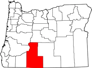 Klamath County map | |
| CDPs | ||
| Other communities | ||
| Indian reservation | ||