Lannédern
Lannedern | |
|---|---|
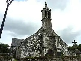 The church of Saint-Edern, in Lannédern | |
Location of Lannédern | |
 Lannédern  Lannédern | |
| Coordinates: 48°18′05″N 3°53′46″W / 48.3014°N 3.8961°W | |
| Country | France |
| Region | Brittany |
| Department | Finistère |
| Arrondissement | Châteaulin |
| Canton | Briec |
| Intercommunality | Pleyben-Châteaulin-Porzay |
| Government | |
| • Mayor (2020–2026) | Pauline Caro[1] |
| Area 1 | 12.43 km2 (4.80 sq mi) |
| Population | 311 |
| • Density | 25/km2 (65/sq mi) |
| Time zone | UTC+01:00 (CET) |
| • Summer (DST) | UTC+02:00 (CEST) |
| INSEE/Postal code | 29115 /29190 |
| Elevation | 80–201 m (262–659 ft) |
| 1 French Land Register data, which excludes lakes, ponds, glaciers > 1 km2 (0.386 sq mi or 247 acres) and river estuaries. | |
Lannédern (French pronunciation: [lanedɛʁn]; Breton: Lannedern) is a commune in the Finistère department of Brittany in north-western France.
Population
| Year | Pop. | ±% p.a. |
|---|---|---|
| 1968 | 477 | — |
| 1975 | 409 | −2.17% |
| 1982 | 361 | −1.77% |
| 1990 | 309 | −1.93% |
| 1999 | 272 | −1.41% |
| 2009 | 306 | +1.18% |
| 2014 | 314 | +0.52% |
| 2020 | 301 | −0.70% |
| Source: INSEE[3] | ||
See also
References
- ↑ "Répertoire national des élus: les maires". data.gouv.fr, Plateforme ouverte des données publiques françaises (in French). 9 August 2021.
- ↑ "Populations légales 2021". The National Institute of Statistics and Economic Studies. 28 December 2023.
- ↑ Population en historique depuis 1968, INSEE
External links
- Base Mérimée: Search for heritage in the commune, Ministère français de la Culture. (in French)
- Mayors of Finistère Association (in French)
Wikimedia Commons has media related to Lannédern.
This article is issued from Wikipedia. The text is licensed under Creative Commons - Attribution - Sharealike. Additional terms may apply for the media files.