M'Pessoba | |
|---|---|
Commune and town | |
%252CML_tue20may2014-1411h.jpg.webp) The old mosque in the town of M'Pessoba (May 2014). | |
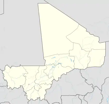 M'Pessoba Location in Mali | |
| Coordinates: 12°39′50″N 5°43′0″W / 12.66389°N 5.71667°W | |
| Country | |
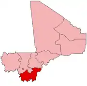
| Region | Sikasso Region |
| Cercle | Koutiala Cercle |
| Area | |
| • Total | 490 km2 (190 sq mi) |
| Population (2009)[2] | |
| • Total | 36,297 |
| • Density | 74/km2 (190/sq mi) |
| Time zone | UTC+0 (GMT) |
M'Pessoba is a small town and commune in the Cercle of Koutiala in the Sikasso Region of southern Mali. The commune covers an area of 490 square kilometers and includes 19 settlements.[3] In the 2009 census it had a population of 36,297.[2] The town of M'Pessoba, the administrative centre (chef-lieu) of the commune, is 40 km northwest of Koutiala.
References
- ↑ Common and Fundamental Operational Datasets Registry: Mali, United Nations Office for the Coordination of Humanitarian Affairs, archived from the original on 2012-01-06. commune_mali.zip (Originally from the Direction Nationale des Collectivités Territoriales, République du Mali)
- 1 2 Resultats RGPH 2009 (Région de Sikasso) (PDF) (in French), République de Mali: Institut National de la Statistique, archived from the original (PDF) on 27 July 2012.
- ↑ Communes de la Région de Sikasso (PDF) (in French), Ministère de l'administration territoriale et des collectivités locales, République du Mali, archived from the original (PDF) on 3 December 2013.
External links
- Plan de Sécurité Alimentaire Commune Rurale de M'Pessoba 2006-2008 (PDF) (in French), Commissariat à la Sécurité Alimentaire, République du Mali, USAID-Mali, 2006, archived from the original (PDF) on 2016-03-05, retrieved 2013-11-24.
This article is issued from Wikipedia. The text is licensed under Creative Commons - Attribution - Sharealike. Additional terms may apply for the media files.