Trompsburg | |
|---|---|
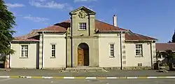 Trompsburg town hall | |
 Trompsburg  Trompsburg | |
| Coordinates: 30°1′S 25°46′E / 30.017°S 25.767°E | |
| Country | South Africa |
| Province | Free State |
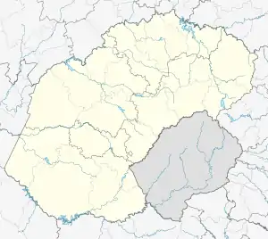
| District | Xhariep |
| Municipality | Kopanong |
| Government | |
| • Type | Municipality |
| • Mayor | Xolani Tseletsele [1] (ANC) |
| Area | |
| • Total | 16.2 km2 (6.3 sq mi) |
| Population (2011)[2] | |
| • Total | 5,338 |
| • Density | 330/km2 (850/sq mi) |
| Racial makeup (2011) | |
| • Black African | 70.2% |
| • Coloured | 22.1% |
| • Indian/Asian | 0.5% |
| • White | 6.6% |
| • Other | 0.6% |
| First languages (2011) | |
| • Sotho | 41.3% |
| • Afrikaans | 35.7% |
| • Xhosa | 15.7% |
| • English | 1.8% |
| • Other | 5.5% |
| Time zone | UTC+2 (SAST) |
| Postal code (street) | 9913 |
| PO box | 9913 |
| Area code | 051 |
Trompsburg is a town in the Free State province of South Africa off the N1 highway, the major road connection between Johannesburg and Cape Town.
Background
The town is 120 km south-west of Bloemfontein and 56 km north-east of Philippolis. It was laid out in 1891 on the farm Middelwater and attained municipal status in 1902. Named after the owners of the farm, Jan and Bastiaan Tromp.[3]: 352 It was at first called Jagersfontein Road, then Hamilton, in honour of Sir Hamilton John Goold-Adams (1858–1920), Lieutenant-Governor of the Orange River Colony from 1901 to 1910.[4]
References
- ↑ Free State Tourism.org Archived 2014-01-06 at the Wayback Machine
- 1 2 3 4 Sum of the Main Places Madikgetla and Trompsburg from Census 2011.
- ↑ Conolly, Denis (1975). The Tourist in South Africa. Travel-Guide (PTY) LTD. ASIN B0000E7XZN.
- ↑ "Dictionary of Southern African Place Names (Public Domain)". Human Science Research Council. p. 438.
Places adjacent to Trompsburg | |
|---|---|
Municipalities and communities of Xhariep District Municipality, Free State | ||
|---|---|---|
District seat: Trompsburg | ||
| Kopanong | .svg.png.webp) Xhariep District within South Africa | |
| Letsemeng | ||
| Mohokare | ||
| Naledi | ||
This article is issued from Wikipedia. The text is licensed under Creative Commons - Attribution - Sharealike. Additional terms may apply for the media files.