Vale do Mucuri | |
|---|---|
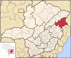 Location within Minas Gerais | |
| Coordinates: 17°51′28″S 41°30′18″W / 17.85778°S 41.50500°W | |
| Country | |
| Region | Southeast |
| State | |
| Area | |
| • Total | 20,080.657 km2 (7,753.185 sq mi) |
| Population (2010/IBGE) | |
| • Total | 370,203 |
| • Density | 18.4/km2 (48/sq mi) |
| Time zone | UTC-3 (BRT) |
| • Summer (DST) | UTC-2 (BRST) |
| CEP postal code | 39000-00 |
| Area code | +55 33 |
Vale do Mucuri (English: Mucuri River valley) is one of the twelve mesoregions of the Brazilian state of Minas Gerais. It is composed of 23 municipalities,[1] distributed across 2 microregions.
References
- ↑ "Produto Interno Bruto dos Municípios" [GDP of the Brazilian Municipalities] (PDF) (in Portuguese). Brazilian Institute of Geography and Statistics (IBGE). 2010-11-01. Archived from the original (PDF) on 2014-04-24. Retrieved 2014-12-23.
This article is issued from Wikipedia. The text is licensed under Creative Commons - Attribution - Sharealike. Additional terms may apply for the media files.