Mazguitam
ⵎⵣⴳⵉⵜⵎ Mezguitem | |
|---|---|
 Mazguitam 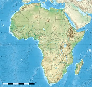 Mazguitam | |
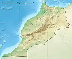
| Coordinates: 34°30′03″N 3°38′28″W / 34.50083°N 3.64111°W | |
| Country | |
| Region | Oriental |
| Province | Guercif |
| Population (2014)[1] | |
| • Total | 8.078 |
| Time zone | UTC+1 (CET) |
Mazguitam, also spelled Mezguitem, is a commune in Guercif Province of the Oriental administrative region of Morocco. The 2014 Moroccan census recorded a population of 8087 people.[1]
Villages
- Ain Mzizoui
- Al Hourach Bab Lakhmiss
- Beni Moussi
- Bougueza
- Bouhlalifene
- Bouzellifene
- Chorfa Angad
- Chorfa Sidi Said
- Douz
- El Hourach
- Guendbour
- Guetara (Ouled Amar Ou Hmed)
- Hamouchen Aamer
- Ibouchtaten
- Ibouichene
- Iboutahrene
- Ifouras
- Ihadhoumene
- Ihadouchen
- Iheyatane
- Imouzar
- Izerfane
- Mezguitem
- Ouled Ali Karieh
- Ouled Mohamed Ou Abdellah
- Ouled Rahou
- Ouled Alla
- R'bouhate
- Sidi Amar
- Sidi Belkacem (Hribchat)
- Sidi El Hadi
- Tilaouline
- Tinri
References
- 1 2
 "POPULATION LÉGALE DES RÉGIONS, PROVINCES, PRÉFECTURES, MUNICIPALITÉS, ARRONDISSEMENTS ET COMMUNES DU ROYAUME D'APRÈS LES RÉSULTATS DU RGPH 2014" (in Arabic and French). High Commission for Planning, Morocco. 8 April 2015. Retrieved 29 September 2017.
 - ↑ http://www.one.org.ma/FR/pages/lvil.asp?esp=2&id1=6&id2=129&t1=1&t2=1&Action=prov
Capital: Guercif | ||
| Municipality | 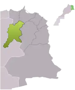 | |
| Rural communes | ||
This article is issued from Wikipedia. The text is licensed under Creative Commons - Attribution - Sharealike. Additional terms may apply for the media files.