Municipal District of Fairview No. 136 | |
|---|---|
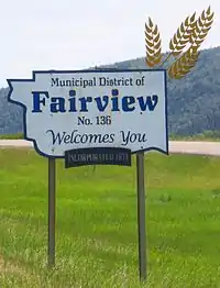 Boundary sign at Dunvegan Bridge | |
|
Logo | |
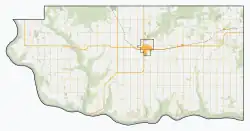
 Location within Alberta | |
| Country | Canada |
| Province | Alberta |
| Region | Northern Alberta |
| Planning region | Upper Peace |
| Established | 1913 |
| Incorporated | 1914 |
| Government | |
| • Reeve | Peggy Johnson |
| • Governing body | M.D. of Fairview Council |
| • Administrative office | Fairview |
| Area (2021)[2] | |
| • Land | 1,373.66 km2 (530.37 sq mi) |
| Population (2021)[2] | |
| • Total | 1,580 |
| • Density | 1.2/km2 (3/sq mi) |
| Time zone | UTC−7 (MST) |
| • Summer (DST) | UTC−6 (MDT) |
| Website | mdfairview.com |
The Municipal District of Fairview No. 136 is a municipal district (MD) in northwestern Alberta, Canada. It is located in Census Division 19.
The district stretches along the northwestern leg of Highway 2.
Geography
Communities and localities
|
The following urban municipalities are surrounded by the MD of Fairview No. 136.[3]
The following hamlets are located within the MD of Fairview No. 136.[3] |
The following localities are located within the MD of Fairview No. 136.[4]
|
Demographics
| Year | Pop. | ±% |
|---|---|---|
| 1916 | 790 | — |
| 1921 | 1,456 | +84.3% |
| 1926 | 1,507 | +3.5% |
| 1931 | 2,264 | +50.2% |
| 1936 | 2,443 | +7.9% |
| 1941 | 2,326 | −4.8% |
| 1946 | 2,074 | −10.8% |
| 1951 | 2,031 | −2.1% |
| 1956 | 1,885 | −7.2% |
| 1961 | 1,917 | +1.7% |
| 1966 | 1,745 | −9.0% |
| 1971 | 1,901 | +8.9% |
| 1976 | 1,755 | −7.7% |
| 1981 | 1,889 | +7.6% |
| 1986 | 1,903 | +0.7% |
| 1991 | 1,812 | −4.8% |
| 1996 | 1,829 | +0.9% |
| 2001 | 1,806 | −1.3% |
| 2006 | 1,432 | −20.7% |
| 2011 | 1,673 | +16.8% |
| 2016 | 1,604 | −4.1% |
| Source: Statistics Canada [5][6][7][8][9][10][11][12][13][14][15] | ||
In the 2021 Census of Population conducted by Statistics Canada, the MD of Fairview No. 136 had a population of 1,580 living in 613 of its 707 total private dwellings, a change of -1.5% from its 2016 population of 1,604. With a land area of 1,373.66 km2 (530.37 sq mi), it had a population density of 1.2/km2 (3.0/sq mi) in 2021.[2]
In the 2016 Census of Population conducted by Statistics Canada, the MD of Fairview No. 136 had a population of 1,604 living in 620 of its 683 total private dwellings, a -4.1% change from its 2011 population of 1,673. With a land area of 1,387.58 km2 (535.75 sq mi), it had a population density of 1.2/km2 (3.0/sq mi) in 2016.[16]
See also
References
- ↑ "Municipal Officials Search". Alberta Municipal Affairs. May 9, 2019. Retrieved October 1, 2021.
- 1 2 3 "Population and dwelling counts: Canada, provinces and territories, and census subdivisions (municipalities)". Statistics Canada. February 9, 2022. Retrieved February 9, 2022.
- 1 2 "Specialized and Rural Municipalities and Their Communities" (PDF). Alberta Municipal Affairs. January 12, 2022. Retrieved January 21, 2022.
- ↑ "Standard Geographical Classification (SGC) 2006, Economic Regions: 4819066 - Fairview No. 136, geographical codes and localities, 2006". Statistics Canada. March 5, 2010. Retrieved August 11, 2012.
- ↑ "Table IV: Population of Prairie Provinces by Municipalities, Local Improvement Districts or Unorganized Territorial Units, 1916". Census of Prairie Provinces, 1916. Ottawa: Department of Trade and Commerce. 1918.
- ↑ "Table 6: Population by census divisions of Alberta classified by municipalities for census years, 1921 and 1926". Census of Prairie Provinces, 1926. Ottawa: Department of Trade and Commerce. 1929.
- ↑ "Table 6: Population by census subdivisions, 1926-1946". Census of the Prairie Provinces, 1946. Vol. I: Population. Ottawa: Dominion Bureau of Statistics. 1949.
- ↑ "Table 6: Population by sex, for census subdivisions, 1956 and 1951". Census of Canada, 1956. Vol. I: Population. Ottawa: Dominion Bureau of Statistics. 1958.
- ↑ "Table 9: Population by census subdivisions, 1966 by sex, and 1961". 1966 Census of Canada. Western Provinces. Vol. Population: Divisions and Subdivisions. Ottawa: Dominion Bureau of Statistics. 1967.
- ↑ "Table 3: Population for census divisions and subdivisions, 1971 and 1976". 1976 Census of Canada. Census Divisions and Subdivisions, Western Provinces and the Territories. Vol. Population: Geographic Distributions. Ottawa: Statistics Canada. 1977.
- ↑ "Table 2: Census Subdivisions in Alphabetical Order, Showing Population Rank, Canada, 1981". 1981 Census of Canada. Vol. Census subdivisions in decreasing population order. Ottawa: Statistics Canada. 1982. ISBN 0-660-51563-6.
- ↑ "Table 2: Population and Dwelling Counts, for Census Divisions and Census Subdivisions, 1986 and 1991 – 100% Data". 91 Census. Vol. Population and Dwelling Counts – Census Divisions and Census Subdivisions. Ottawa: Statistics Canada. 1992. pp. 100–108. ISBN 0-660-57115-3.
- ↑ "Population and Dwelling Counts, for Canada, Provinces and Territories, and Census Divisions, 2001 and 1996 Censuses – 100% Data (Alberta)". Statistics Canada. Retrieved May 28, 2019.
- ↑ "Population and dwelling counts, for Canada, provinces and territories, and census subdivisions (municipalities), 2006 and 2001 censuses – 100% data (Alberta)". Statistics Canada. January 6, 2010. Retrieved May 28, 2019.
- ↑ "Census Profile, 2016 Census". Statistics Canada. February 8, 2017. Retrieved May 28, 2019.
- ↑ "Population and dwelling counts, for Canada, provinces and territories, and census subdivisions (municipalities), 2016 and 2011 censuses – 100% data (Alberta)". Statistics Canada. February 8, 2017. Retrieved February 8, 2017.