Naundorf | |
|---|---|
 Coat of arms | |
Location of Naundorf | |
 Naundorf 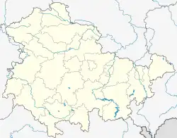 Naundorf | |
| Coordinates: 50°58′7″N 12°16′29″E / 50.96861°N 12.27472°E | |
| Country | Germany |
| State | Thuringia |
| District | Altenburger Land |
| Town | Starkenberg |
| Area | |
| • Total | 10.88 km2 (4.20 sq mi) |
| Elevation | 240 m (790 ft) |
| Population (2006-12-31) | |
| • Total | 522 |
| • Density | 48/km2 (120/sq mi) |
| Time zone | UTC+01:00 (CET) |
| • Summer (DST) | UTC+02:00 (CEST) |
| Postal codes | 04617 |
| Dialling codes | 034495 |
Naundorf is a village and a former municipality in the district Altenburger Land, in Thuringia, Germany. Since 1 December 2008, it has been part of Starkenberg.
This article is issued from Wikipedia. The text is licensed under Creative Commons - Attribution - Sharealike. Additional terms may apply for the media files.