Nijefurd | |
|---|---|
Former municipality | |
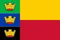 Flag 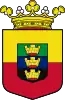 Coat of arms | |
 | |
| Coordinates: 52°59′N 5°26′E / 52.983°N 5.433°E | |
| Country | Netherlands |
| Province | Friesland |
| Municipality | Súdwest-Fryslân |
| Area (2006) | |
| • Total | 289.17 km2 (111.65 sq mi) |
| • Land | 96.68 km2 (37.33 sq mi) |
| • Water | 192.49 km2 (74.32 sq mi) |
| Population (1 January, 2007) | |
| • Total | 10,887 |
| • Density | 113/km2 (290/sq mi) |
| Source: CBS, Statline. | |
| Time zone | UTC+1 (CET) |
| • Summer (DST) | UTC+2 (CEST) |
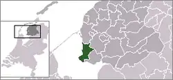
Nijefurd (Dutch pronunciation: [ˈnɛiəfʏrt] ⓘ) is a former municipality in the northern Netherlands, in the province of Friesland.
History
It was formed in 1984 from the old municipalities of Hindeloopen, Stavoren, and Workum, and part of Hemelumer Oldeferd.
In 2011, it formed together with the municipalities of Bolsward, Sneek, Wûnseradiel and Wymbritseradiel the new municipality Súdwest Fryslân.
Population centres
External links
![]() Media related to Nijefurd at Wikimedia Commons
Media related to Nijefurd at Wikimedia Commons
This article is issued from Wikipedia. The text is licensed under Creative Commons - Attribution - Sharealike. Additional terms may apply for the media files.