Nohra | |
|---|---|
_1.jpg.webp) | |
 Coat of arms | |
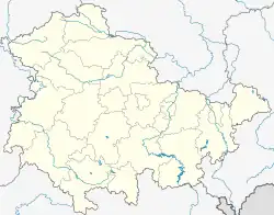
Location of Nohra | |
 Nohra  Nohra | |
| Coordinates: 51°26′N 10°42′E / 51.433°N 10.700°E | |
| Country | Germany |
| State | Thuringia |
| District | Nordhausen |
| Town | Bleicherode |
| Area | |
| • Total | 16.09 km2 (6.21 sq mi) |
| Elevation | 212 m (696 ft) |
| Population (2017-12-31) | |
| • Total | 811 |
| • Density | 50/km2 (130/sq mi) |
| Time zone | UTC+01:00 (CET) |
| • Summer (DST) | UTC+02:00 (CEST) |
| Postal codes | 99735 |
| Dialling codes | 036334 |
Nohra is a village and a former municipality in the district of Nordhausen, in Thuringia, Germany. As of 2018, Nohra had a population of 799.[1]
Nohra was first mentioned on 9 January 1152.[2]
Since 1 January 2019, it is part of the town of Bleicherode.[3]
References
- ↑ Bevölkerung der Gemeinden, erfüllenden Gemeinden und Verwaltungsgemeinschaften nach Geschlecht in Thüringen
- ↑ Kahl, Wolfgang (2010). Ersterwähnung Thüringer Städte und Dörfer. Ein Handbuch. Bad Langensalza: Verlag Rockstuhl. p. 202. ISBN 978-3-86777-202-0.
- ↑ "Thüringer Gesetz zur freiwilligen Neugliederung kreisangehöriger Gemeinden im Jahr 2019 vom 18. Dezember 2018, § 17" (PDF) (in German). Archived from the original (PDF) on 9 January 2019. Retrieved 28 June 2020.
This article is issued from Wikipedia. The text is licensed under Creative Commons - Attribution - Sharealike. Additional terms may apply for the media files.