Buk-gu
북구 | |
|---|---|
| Korean transcription(s) | |
| • Hanja | 北區 |
| • Revised Romanization | Buk-gu |
| • McCune-Reischauer | Puk-ku |
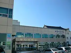 Buk-gu Office | |
 | |
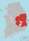
| Country | South Korea |
| Region | Yeongnam |
| Province | North Gyeongsang |
| City | Pohang |
| Administrative divisions | 8 dong, 1 eup, 6 myeon |
| Area | |
| • Total | 734.8 km2 (283.7 sq mi) |
| Population (2012.11) | |
| • Total | 267,523[1] |
| • Density | 364/km2 (940/sq mi) |
| • Dialect | Gyeongsang |
| Website | bukgu.ipohang.org |
Buk-gu is a non-autonomous district in the City of Pohang in North Gyeongsang Province, South Korea.
Administrative divisions
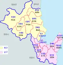
Pohang eup/myeon/dong map in Korean. Yellow is Buk-gu and Purple is Nam-gu.
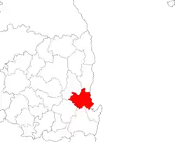
Inset map. Yellow is Buk-gu and Purple is Nam-gu.
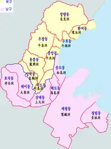
Buk-gu is divided into one town (eup), 6 townships (myeon), and 8 neighbourhoods (dong).[1]
| Hangul | Hanja | |
|---|---|---|
| Heunghae-eup | 흥해읍 | 興海邑 |
| Singwang-myeon | 신광면 | 神光面 |
| Cheongha-myeon | 청하면 | 淸河面 |
| Songna-myeon | 송라면 | 松羅面 |
| Gigye-myeon | 기계면 | 杞溪面 |
| Jukjang-myeon | 죽장면 | 竹長面 |
| Gibuk-myeon | 기북면 | 杞北面 |
| Jungang-dong | 중앙동 | 中央洞 |
| Yanghak-dong | 양학동 | 良鶴洞 |
| Jukdo-dong | 죽도동 | 竹島洞 |
| Yongheung-dong | 용흥동 | 龍興洞 |
| Uchang-dong | 우창동 | 牛昌洞 |
| Duho-dong | 두호동 | 斗湖洞 |
| Jangnyang-dong | 장량동 | 長良洞 |
| Hwanyeo-dong | 환여동 | 環汝洞 |
Points of interest
- Anguksa, a Hindu temple
See also
References
- 1 2 포항시 북구청 기본현황 인구/면적 - Buk-gu, Pohang City Archived July 8, 2011, at the Wayback Machine
External links
- (in Korean) Official website
36°02′31″N 129°21′56″E / 36.041867°N 129.365688°E
Andong (capital) | ||||
 | Specific city |
| ||
| Cities | ||||
| Counties | ||||
This article is issued from Wikipedia. The text is licensed under Creative Commons - Attribution - Sharealike. Additional terms may apply for the media files.