Obermehler | |
|---|---|
 Church of Saint Ulrich | |
 Coat of arms | |
Location of Obermehler | |
 Obermehler 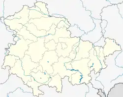 Obermehler | |
| Coordinates: 51°16′N 10°35′E / 51.267°N 10.583°E | |
| Country | Germany |
| State | Thuringia |
| District | Unstrut-Hainich-Kreis |
| Town | Nottertal-Heilinger Höhen |
| Area | |
| • Total | 21.64 km2 (8.36 sq mi) |
| Elevation | 268 m (879 ft) |
| Population (2018-12-31) | |
| • Total | 1,245 |
| • Density | 58/km2 (150/sq mi) |
| Time zone | UTC+01:00 (CET) |
| • Summer (DST) | UTC+02:00 (CEST) |
| Postal codes | 99996 |
| Dialling codes | 036021 |
Obermehler is a village and a former municipality in the Unstrut-Hainich-Kreis district of Thuringia, Germany. Since December 2019, it is part of the town Nottertal-Heilinger Höhen.
History
Within the German Empire (1871-1918), Obermehler was part of the Duchy of Saxe-Coburg and Gotha.
References
This article is issued from Wikipedia. The text is licensed under Creative Commons - Attribution - Sharealike. Additional terms may apply for the media files.