Oberried | |
|---|---|
 Coat of arms | |
Location of Oberried within Breisgau-Hochschwarzwald district  | |
 Oberried 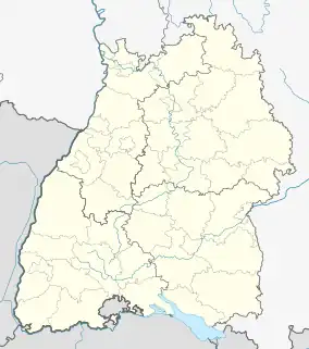 Oberried | |
| Coordinates: 47°55′55″N 7°56′50″E / 47.93194°N 7.94722°E | |
| Country | Germany |
| State | Baden-Württemberg |
| Admin. region | Freiburg |
| District | Breisgau-Hochschwarzwald |
| Subdivisions | 4 |
| Government | |
| • Mayor (2021–29) | Klaus Vosberg[1] (CDU) |
| Area | |
| • Total | 66.32 km2 (25.61 sq mi) |
| Elevation | 460 m (1,510 ft) |
| Population (2021-12-31)[2] | |
| • Total | 2,833 |
| • Density | 43/km2 (110/sq mi) |
| Time zone | UTC+01:00 (CET) |
| • Summer (DST) | UTC+02:00 (CEST) |
| Postal codes | 79254 |
| Dialling codes | 07661 |
| Vehicle registration | FR |
| Website | www.oberried.de |
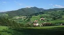
View from Goldberg on the village Oberried and into the Dreisam Valley
Oberried is a town in the district of Breisgau-Hochschwarzwald in Baden-Württemberg in southern Germany.
Oberried is home to the Barbarastollen caves, the central safekeeping archive of Germany. The Barbarastollen holds microfilms with millions of images from German archives and museums.[3]
Demographics
Population development:[4]
|
References
- ↑ Aktuelle Wahlergebnisse, Staatsanzeiger, accessed 11 September 2021.
- ↑ "Bevölkerung nach Nationalität und Geschlecht am 31. Dezember 2021" [Population by nationality and sex as of December 31, 2021] (CSV) (in German). Statistisches Landesamt Baden-Württemberg. June 2022.
- ↑ Barbarastollen in the German Wikipedia
- ↑ "Oberried (Breisgau-Hochschwarzwald, Baden-Württemberg, Deutschland) - Einwohnerzahlen, Grafiken, Karte, Lage, Wetter und Web-Informationen". www.citypopulation.de. Retrieved 2023-12-11.
This article is issued from Wikipedia. The text is licensed under Creative Commons - Attribution - Sharealike. Additional terms may apply for the media files.