| Pic de Serra Gallinera | |
|---|---|
 | |
| Highest point | |
| Elevation | 2,663 m (8,737 ft) |
| Coordinates | 42°27′02″N 2°15′18″E / 42.45056°N 2.25500°E |
| Geography | |
| Location | Pyrénées-Orientales, in Occitanie, France |
| Parent range | Pyrenees |
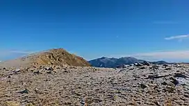
Pic de Serra Gallinera is a mountain of Pyrénées-Orientales, Occitanie, France. Located in the Pyrenees, it has an elevation of 2,663 metres (8,737 ft) above sea level.
This article is issued from Wikipedia. The text is licensed under Creative Commons - Attribution - Sharealike. Additional terms may apply for the media files.