Ergolding | |
|---|---|
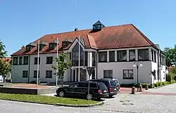 Town hall | |
 Coat of arms | |
Location of Ergolding within Landshut district 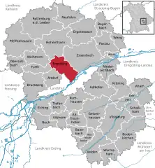 | |
 Ergolding 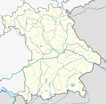 Ergolding | |
| Coordinates: 48°35′N 12°10′E / 48.583°N 12.167°E | |
| Country | Germany |
| State | Bavaria |
| Admin. region | Niederbayern |
| District | Landshut |
| Subdivisions | 24 Ortsteile |
| Government | |
| • Mayor (2020–26) | Andreas Strauß[1] (FW) |
| Area | |
| • Total | 37.16 km2 (14.35 sq mi) |
| Elevation | 392 m (1,286 ft) |
| Population (2022-12-31)[2] | |
| • Total | 13,272 |
| • Density | 360/km2 (930/sq mi) |
| Time zone | UTC+01:00 (CET) |
| • Summer (DST) | UTC+02:00 (CEST) |
| Postal codes | 84030 |
| Dialling codes | 0871 |
| Vehicle registration | LA |
| Website | www.ergolding.de |
Ergolding (Central Bavarian: Erwading) is a municipality in the district of Landshut, in Bavaria, Germany. It is situated on the left bank of the Isar, 5 km northeast of Landshut.
References
- ↑ Liste der ersten Bürgermeister/Oberbürgermeister in kreisangehörigen Gemeinden, Bayerisches Landesamt für Statistik, 15 July 2021.
- ↑ Genesis Online-Datenbank des Bayerischen Landesamtes für Statistik Tabelle 12411-003r Fortschreibung des Bevölkerungsstandes: Gemeinden, Stichtag (Einwohnerzahlen auf Grundlage des Zensus 2011)
This article is issued from Wikipedia. The text is licensed under Creative Commons - Attribution - Sharealike. Additional terms may apply for the media files.