Rača | |
|---|---|
Borough | |
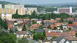 Old Rača versus new Rača | |
 Coat of arms | |
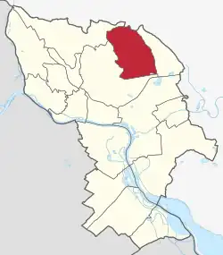 Area of Rača in Bratislava | |
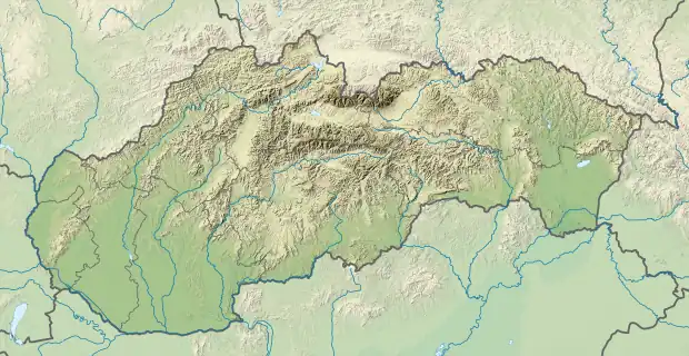 Rača Location of Rača in Slovakia | |
| Coordinates: 48°08′00″N 17°07′00″E / 48.13333°N 17.11667°E | |
| Country | |
| Region | |
| District | Bratislava III |
| First mentioned | 1226 (Julian) |
| Government | |
| • Mayor | Michal Drotován |
| Area | |
| • Total | 23.66 km2 (9.14 sq mi) |
| Elevation | 148 m (486 ft) |
| Population (1 January 2021) | |
| • Total | 25,733 |
| • Density | 1,100/km2 (2,800/sq mi) |
| Time zone | UTC+1 (CET) |
| • Summer (DST) | UTC+2 (CEST) |
| Postal code | 831 06 |
| Area code | +421-2 |
| Car plate | BA, BL, BT |
| Website | www |
Rača is a borough of Bratislava, Slovakia, in the Bratislava III district.
Names and etymology
The name probably comes from the Slavic personal name Radša/Radoslav or the Slavic stem vorč-/vrača (a fence).[1] [lower-alpha 1] The name was adopted by Germans as Rechesdorf (literally Rača's village, 1390). The Germanized form had been used even by the Slovaks themselves, e.g., Račissdorf (1914), Račištorf (1920-1946) except for a short period in 1920 when the official name was Raslavice. In 1946, its original name Rača was restored.[2]
History
Rača was mentioned for the first time in 1296 as a vineyard village under the name villa Racha. In 1946, the village became a borough of Bratislava.
Notes
- ↑ Although historic records mention a person Racha/Rechee, the personal name could be derived from the name of the village and not otherwise.
References
- ↑ Ondruš, Šimon (1990). "Rača, Vrača > Brača, Vrakuňa a vrkoč" (PDF). Slovenská reč (in Slovak) (1): 32.
- ↑ Horňanský, Imrich (2016). "Z osudov slovenských geografických názvov". Slovenské slovo (in Slovak) (16).
External links
This article is issued from Wikipedia. The text is licensed under Creative Commons - Attribution - Sharealike. Additional terms may apply for the media files.