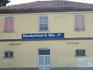
Ripabottoni San Elia a Pianisi Railway Station Stazione di Ripabottoni-S.Elia | |
|---|---|
 | |
| General information | |
| Location | Contrada Cerro Ripabottoni, Campobasso, Molise Italy |
| Coordinates | 41°41′11.28″N 14°50′39.12″E / 41.6864667°N 14.8442000°E |
| Operated by | Rete Ferroviaria Italiana |
| Line(s) | Termoli-Campobasso Termoli–Venafro |
| Platforms | 2 |
| Tracks | 2 |
| Train operators | Trenitalia |
| Other information | |
| Classification | Bronze |
| History | |
| Opened | 1883 |
| Electrified | no |
| Location | |
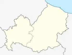 Ripabottoni San Elia a Pianisi Railway Station Location in Molise  Ripabottoni San Elia a Pianisi Railway Station Location in Italy | |
Ripabottoni-S.Elia or Ripabottoni-Sant'Elia Railway station is an Italian train station in Province of Campobasso, Molise, that serves the municipalities of Ripabottoni and Sant'Elia a Pianisi. It is situated in the Ripabottoni territory.[1]
References
Bibliography
- Rif.Legge Baccarini(L. 29 luglio 1879, n. 5002), Relazione statistica sulle costruzioni e sull'esercizio delle strade ferrate italiane per l'anno 1882 (1883). MINISTERO DEI LAVORI PUBBLICI. DIREZIONE GENERALE DELLE STRADE FERRATE (in Italian). Rome: Tipografia Eredi Botta, 1883. p. 116. Retrieved 22 May 2017.
{{cite book}}: CS1 maint: numeric names: authors list (link)
This article is based upon a translation of the Italian language version as at May 2017.
| Ripabottoni-S.Elia railway station | |||||||||||||||||||||||||||||||||||||||||||||||
|---|---|---|---|---|---|---|---|---|---|---|---|---|---|---|---|---|---|---|---|---|---|---|---|---|---|---|---|---|---|---|---|---|---|---|---|---|---|---|---|---|---|---|---|---|---|---|---|
| |||||||||||||||||||||||||||||||||||||||||||||||
This article is issued from Wikipedia. The text is licensed under Creative Commons - Attribution - Sharealike. Additional terms may apply for the media files.