Shahriston District
| |
|---|---|
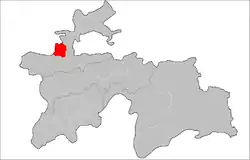 Location of Shahriston District in Tajikistan | |
| Coordinates: 39°42′N 68°45′E / 39.700°N 68.750°E | |
| Country | |
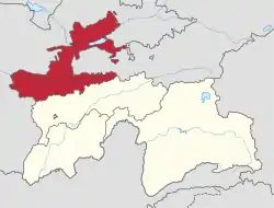
| Region | Sughd Region |
| Capital | Shahriston |
| Area | |
| • Total | 1,100 km2 (400 sq mi) |
| Population (2020)[1] | |
| • Total | 43,700 |
| • Density | 40/km2 (100/sq mi) |
| Time zone | UTC+5 (TJT) |
| Official languages | |
Shahriston District (Russian: Шахристанский район; Tajik: Ноҳияи Шаҳристон Nohiyai Shahriston) is a district in Sughd Region, Tajikistan. Its capital is Shahriston. The population of the district is 43,700 (January 2020 estimate).[1]
Administrative divisions
The district has an area of about 1,100 km2 (400 sq mi) and is divided administratively into two jamoats.[3] They are as follows:[4]
| Jamoat | Population (Jan. 2015)[4] |
|---|---|
| Bunjikat | 15,344 |
| Shahriston | 22,903 |
Artefact
.jpg.webp) Bowl from Shahristan, Tajikistan, 9-11th century, National Museum of Antiquities of Tajikistan (113-218)
Bowl from Shahristan, Tajikistan, 9-11th century, National Museum of Antiquities of Tajikistan (113-218).jpg.webp) Ewer from Shahristan, Tajikistan, 9-11th century, National Museum of Tajikistan (KV 13752)
Ewer from Shahristan, Tajikistan, 9-11th century, National Museum of Tajikistan (KV 13752)
References
- 1 2 "Population of the Republic of Tajikistan as of 1 January 2020" (PDF) (in Russian). Statistics office of Tajikistan. Retrieved 12 October 2020.
- ↑ "КОНСТИТУЦИЯ РЕСПУБЛИКИ ТАДЖИКИСТАН". prokuratura.tj. Parliament of Tajikistan. Retrieved 9 January 2020.
- ↑ "Regions of the Republic of Tajikistan 2017" (PDF) (in Russian). Statistics office of Tajikistan. pp. 15–21. Retrieved 12 October 2020.
- 1 2 Jamoat-level basic indicators, United Nations Development Programme in Tajikistan, accessed 3 October 2020
Capital: Khujand | |||||||||||||||||||||||||
|  | ||||||||||||||||||||||||
|
| |||||||||||||||||||||||||
| |||||||||||||||||||||||||
This article is issued from Wikipedia. The text is licensed under Creative Commons - Attribution - Sharealike. Additional terms may apply for the media files.