Sharana
شاران | |
|---|---|
City | |
 | |
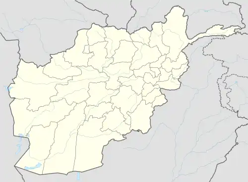 Sharana Location in Afghanistan | |
| Coordinates: 33°7′48″N 68°46′48″E / 33.13000°N 68.78000°E | |
| Country | |
| Province | Paktika |
| District | Sharana |
| Elevation | 2,200 m (7,200 ft) |
| Population (2010) | |
| • City | 5,929 |
| • Urban | 15,651[1] |
| Time zone | UTC+4:30 |
Sharana (Pashto: ښرنه) or Sharan (Persian: شاران) is the capital of Paktika Province, Afghanistan. It is located at an altitude of 2,200 meters.[2] Its population was estimated to be 2,200 in 2006.[3] The city of Sharana has a population of 15,651 (in 2015)[4] and is located within the heartland of the Sulaimankhel tribe of Ghilji Pashtuns.[5] It has 6 districts and a total land area of 5,893 hectares.[6] The total number of dwellings in this city are 1,739.[6]
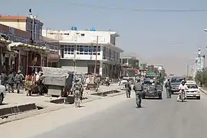
On 14 August 2021, Sharana was seized by Taliban fighters, becoming the twentieth provincial capital to be captured by the Taliban as part of the wider 2021 Taliban offensive.[7]
Climate
With an influence from the local steppe climate, Sharana features a cold semi-arid climate (BSk) under the Köppen climate classification. The average temperature in Sharana is 10.8 °C, while the annual precipitation averages 265 mm. September is the driest month with 1 mm of rainfall, while March, the wettest month, has an average precipitation of 54 mm.
July is the warmest month of the year with an average temperature of 23.6 °C. The coldest month January has an average temperature of -4.5 °C, with the average lows at -10.9 °C.
| Climate data for Sharana | |||||||||||||
|---|---|---|---|---|---|---|---|---|---|---|---|---|---|
| Month | Jan | Feb | Mar | Apr | May | Jun | Jul | Aug | Sep | Oct | Nov | Dec | Year |
| Mean daily maximum °C (°F) | 2.0 (35.6) |
4.8 (40.6) |
11.4 (52.5) |
17.9 (64.2) |
23.8 (74.8) |
29.6 (85.3) |
31.2 (88.2) |
30.4 (86.7) |
27.3 (81.1) |
20.5 (68.9) |
13.2 (55.8) |
6.7 (44.1) |
18.2 (64.8) |
| Daily mean °C (°F) | −4.5 (23.9) |
−1.5 (29.3) |
5.3 (41.5) |
11.0 (51.8) |
16.0 (60.8) |
21.3 (70.3) |
23.6 (74.5) |
22.6 (72.7) |
18.4 (65.1) |
11.7 (53.1) |
5.4 (41.7) |
−0.2 (31.6) |
10.8 (51.4) |
| Mean daily minimum °C (°F) | −10.9 (12.4) |
−7.7 (18.1) |
−0.8 (30.6) |
4.2 (39.6) |
8.3 (46.9) |
13.1 (55.6) |
16.0 (60.8) |
14.9 (58.8) |
9.6 (49.3) |
3.0 (37.4) |
−2.4 (27.7) |
−7.0 (19.4) |
3.4 (38.1) |
| Average precipitation mm (inches) | 36 (1.4) |
51 (2.0) |
54 (2.1) |
37 (1.5) |
14 (0.6) |
11 (0.4) |
18 (0.7) |
13 (0.5) |
4 (0.2) |
4 (0.2) |
13 (0.5) |
20 (0.8) |
275 (10.9) |
| Average precipitation days | 4 | 5 | 6 | 4 | 2 | 2 | 3 | 2 | 1 | 1 | 2 | 3 | 35 |
| Average relative humidity (%) | 57 | 67 | 61 | 45 | 30 | 29 | 39 | 42 | 32 | 29 | 45 | 49 | 44 |
| Source: Climate-Data.org[8] | |||||||||||||
Land use
Barren land and agriculture account for 73% of total land. Sharana has the largest share of land classified as institutional (14%) of any Afghan provincial capital.[6]
See also
References
- ↑ "The State of Afghan Cities report 2015".
- ↑ "what is the elevation of sharan, afghanistan? - Wolfram|Alpha". www.wolframalpha.com. Retrieved 21 August 2021.
- ↑ "Afghanistan: Provinces, Districts, Cities, Towns, City Districts - Population Statistics in Maps and Charts". www.citypopulation.de.
- ↑ "State of Afghan Cities report 2015 (Volume-I English) | UN-Habitat". unhabitat.org. Retrieved 21 August 2021.
- ↑ Paktika Province Tribal Map (Page 11). Naval Postgraduate School.
- 1 2 3 "State of Afghan Cities report 2015 (Volume-II) | UN-Habitat". unhabitat.org. Retrieved 21 August 2021.
- ↑ Seir, Ahmad; Faietz, Rahim; Krauss, Joseph (14 August 2021). "Taliban approach capital's outskirts, attack northern city". Associated Press News. Retrieved 14 August 2021.
- ↑ "Climate: Sharan - Climate-Data.org". Retrieved 9 September 2016.
| Districts | 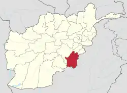 | |
|---|---|---|
| Populated places | ||
| Other | ||