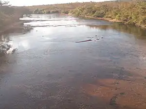
| Tamitatoala River | |
|---|---|
 | |
| Location | |
| Country | Brazil |
| Physical characteristics | |
| Mouth | Ronuro River |
• location | BR |
• coordinates | 11°57′03″S 53°32′49″W / 11.95083°S 53.54694°W |
| Length | 330 km (210 mi)[1] |
See also
References
- ↑ Ziesler, R.; Ardizzone, G.D. (1979). "Amazon River System". The Inland waters of Latin America. Food and Agriculture Organization of the United Nations. ISBN 92-5-000780-9. Archived from the original on 21 October 2013.
This article is issued from Wikipedia. The text is licensed under Creative Commons - Attribution - Sharealike. Additional terms may apply for the media files.