Vārkava Municipality
Vārkavas novads | |
|---|---|
 Flag  Coat of arms | |
 | |
| Country | |
| Formed | 2002 |
| Centre | Vecvārkava |
| Government | |
| • Council Chair | Anita Brakovska (Our Time) |
| Area | |
| • Total | 287.73 km2 (111.09 sq mi) |
| • Land | 280.48 km2 (108.29 sq mi) |
| • Water | 7.25 km2 (2.80 sq mi) |
| Population (2021)[2] | |
| • Total | 1,754 |
| • Density | 6.1/km2 (16/sq mi) |
| Website | www |
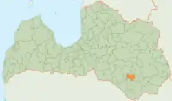
Vārkava Municipality (Latvian: Vārkavas novads) is a former municipality in Latgale, Latvia. The municipality was formed in 2002 by merging Rožkalni Parish and Upmala Parish. In 2009 it absorbed Vārkava Parish, too; the administrative centre being Vecvārkava. The population in 2020 was 1,793.[3]
On 1 July 2021, Vārkava Municipality ceased to exist and its territory was merged into Preiļi Municipality.[4]
See also
References
- ↑ Error: Unable to display the reference properly. See the documentation for details.
- ↑ Error: Unable to display the reference properly. See the documentation for details.
- ↑ "ISG020. Population number and its change by statistical region, city, town, 21 development centres and counties". Central Statistical Bureau of Latvia. 2020-01-01. Retrieved 2021-02-12.
- ↑ Law on Administrative Territories and Populated Areas
56°16′30″N 26°39′30″E / 56.27500°N 26.65833°E
This article is issued from Wikipedia. The text is licensed under Creative Commons - Attribution - Sharealike. Additional terms may apply for the media files.