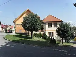
Čečelovice | |
|---|---|
 Municipal office | |
 Flag  Coat of arms | |
 Čečelovice Location in the Czech Republic | |
| Coordinates: 49°22′27″N 13°47′42″E / 49.37417°N 13.79500°E | |
| Country | |
| Region | South Bohemian |
| District | Strakonice |
| First mentioned | 1412 |
| Area | |
| • Total | 6.55 km2 (2.53 sq mi) |
| Elevation | 554 m (1,818 ft) |
| Population (2023-01-01)[1] | |
| • Total | 193 |
| • Density | 29/km2 (76/sq mi) |
| Time zone | UTC+1 (CET) |
| • Summer (DST) | UTC+2 (CEST) |
| Postal code | 388 01 |
| Website | www |
Čečelovice is a municipality and village in Strakonice District in the South Bohemian Region of the Czech Republic. It has about 200 inhabitants.
Čečelovice lies approximately 15 kilometres (9 mi) north-west of Strakonice, 66 km (41 mi) north-west of České Budějovice, and 92 km (57 mi) south-west of Prague.
References
Wikimedia Commons has media related to Čečelovice.
This article is issued from Wikipedia. The text is licensed under Creative Commons - Attribution - Sharealike. Additional terms may apply for the media files.