İslahiye | |
|---|---|
District and municipality | |
 Map showing İslahiye District in Gaziantep Province | |
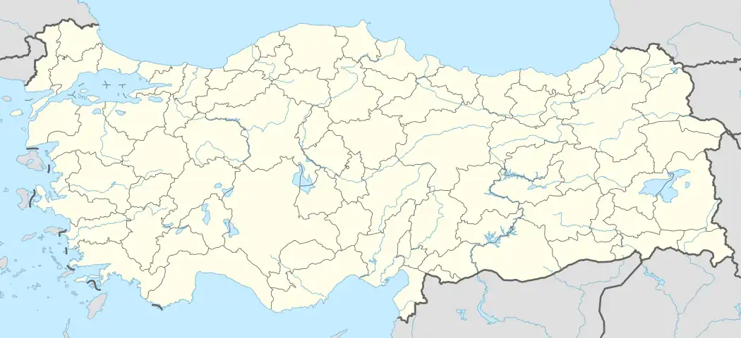 İslahiye Location in Turkey | |
| Coordinates: 37°01′30″N 36°38′04.20″E / 37.02500°N 36.6345000°E | |
| Country | Turkey |
| Province | Gaziantep |
| Government | |
| • Mayor | Kemal Vural (AKP) |
| Area | 865 km2 (334 sq mi) |
| Population (2022)[1] | 67,650 |
| • Density | 78/km2 (200/sq mi) |
| Time zone | TRT (UTC+3) |
| Postal code | 27800 |
| Area code | 0342 |
| Website | www |
İslahiye is a municipality and district of Gaziantep Province, Turkey.[2] Its area is 865 km2,[3] and its population is 67,650 (2022).[1] It is a railway border crossing into Syria. Near İslahiye is the site of ancient Nicopolis.[4]
The railway station of Islahiye is the last stop on the railway to Damascus in Syria. Since March 2001, a regular train line runs once a week between Syria and Iran via Islahiye.[5] The state road D.825, which connects Gaziantep with Antakya, runs through İslahiye.
The town is inhabited by Yörüks of the Aydınlı tribe.[6] English traveler Mark Sykes recorded İslahiye as a town inhabited by Turks in early 20th century.[7]
A magnitude 7.8 earthquake struck İslahiye on 6 February 2023, causing widespread devastation in the town and many deaths.[8]
Composition
There are 71 neighbourhoods in İslahiye District:[9]
- Ağabey
- Ağalarobası
- Akınyolu
- Alaca
- Altınüzüm
- Arpalı
- Atatürk
- Aydınlık
- Bahçelievler
- Bayraktepe
- Beyler
- Boğaziçi
- Burhaniye
- Burunsuzlar
- Çamlıca
- Çerçili
- Cevdetpaşa
- Çınarlı
- Çolaklar
- Çubuk
- Cumhuriyet
- Değirmencik
- Dervişpaşa
- Elbistanhüyüğü
- Erenler
- Esenler
- Fevziçakmak
- Fevzipaşa
- Göltepe
- Güllühüyük
- Güngören
- Hacı Ali Öztürk
- Hanağzı
- Hasanlök
- Hürriyet
- İdilli
- Kabaklar
- Kalaycık
- Kale
- Karacaören
- Karakaya
- Karapınar
- Karapolat
- Kayabaşı
- Kazıklı
- Kırıkçalı
- Koçcağız
- Köklü
- Kozdere
- Kuşçumustafa
- Ortaklı
- Örtülü
- Pınarbaşı
- Şahmaran
- Şerikanlı
- Serinevler
- Sulumağara
- Tandır
- Telli
- Türkbahçe
- Yağızlar
- Yelliburun
- Yeni
- Yeniceli
- Yeniköy
- Yesemek
- Yeşilova
- Yeşilyurt
- Yolbaşı
- Yukarıbilenler
- Zincirli
Climate
İslahiye has a hot-summer Mediterranean climate (Köppen: Csa),[10] with very hot, dry summers, and cool, wet winters.
| Climate data for İslahiye (1991–2020) | |||||||||||||
|---|---|---|---|---|---|---|---|---|---|---|---|---|---|
| Month | Jan | Feb | Mar | Apr | May | Jun | Jul | Aug | Sep | Oct | Nov | Dec | Year |
| Mean daily maximum °C (°F) | 9.9 (49.8) |
12.0 (53.6) |
16.5 (61.7) |
22.1 (71.8) |
28.2 (82.8) |
33.4 (92.1) |
36.8 (98.2) |
37.1 (98.8) |
33.4 (92.1) |
26.9 (80.4) |
18.0 (64.4) |
11.6 (52.9) |
23.9 (75.0) |
| Daily mean °C (°F) | 5.5 (41.9) |
6.7 (44.1) |
10.7 (51.3) |
15.2 (59.4) |
20.6 (69.1) |
25.7 (78.3) |
28.9 (84.0) |
28.9 (84.0) |
25.2 (77.4) |
19.3 (66.7) |
11.7 (53.1) |
7.1 (44.8) |
17.2 (63.0) |
| Mean daily minimum °C (°F) | 1.4 (34.5) |
2.0 (35.6) |
5.3 (41.5) |
8.7 (47.7) |
13.2 (55.8) |
17.6 (63.7) |
20.7 (69.3) |
21.1 (70.0) |
17.7 (63.9) |
12.8 (55.0) |
6.4 (43.5) |
3.1 (37.6) |
10.9 (51.6) |
| Average precipitation mm (inches) | 139.5 (5.49) |
136.04 (5.36) |
111.36 (4.38) |
67.66 (2.66) |
33.19 (1.31) |
7.94 (0.31) |
1.27 (0.05) |
0.99 (0.04) |
16.19 (0.64) |
49.43 (1.95) |
87.86 (3.46) |
148.67 (5.85) |
800.1 (31.50) |
| Source: NOAA[11] | |||||||||||||
See also
References
- 1 2 "Address-based population registration system (ADNKS) results dated 31 December 2022, Favorite Reports" (XLS). TÜİK. Retrieved 12 July 2023.
- ↑ Büyükşehir İlçe Belediyesi, Turkey Civil Administration Departments Inventory. Retrieved 12 July 2023.
- ↑ "İl ve İlçe Yüz ölçümleri". General Directorate of Mapping. Retrieved 12 July 2023.
- ↑ Lund University. Digital Atlas of the Roman Empire.
- ↑ "Ulaşım" (in Turkish). Islahiye Kaymakamlığı. Retrieved March 15, 2009.
- ↑ Aşiretler raporu (in Turkish) (3rd ed.). Kaynak Yayınları. 2014. p. 147.
- ↑ Sykes, Mark (1904). Dar-ul-Islam: A Record of a Journey Through Ten of the Asiatic Provinces of Turkey. Bickers & Son. p. 261.
- ↑ "Islahiye, a city devastated by the earthquake: 'We spend our days feeling thankful for being alive'". El País. 2023-02-10.
- ↑ Mahalle, Turkey Civil Administration Departments Inventory. Retrieved 12 July 2023.
- ↑ "Table 1 Overview of the Köppen-Geiger climate classes including the defining criteria". Nature: Scientific Data.
- ↑ "World Meteorological Organization Climate Normals for 1991-2020 — İslahiye". National Oceanic and Atmospheric Administration. Retrieved January 15, 2024.
İslahiye in Gaziantep Province of Turkey | |||||||||||||||||||||||||||
|---|---|---|---|---|---|---|---|---|---|---|---|---|---|---|---|---|---|---|---|---|---|---|---|---|---|---|---|
| Districts | 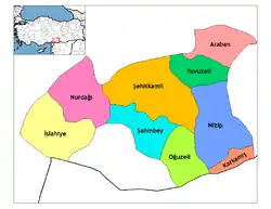 Districts of Gaziantep | ||||||||||||||||||||||||||
| |||||||||||||||||||||||||||
Metropolitan municipalities are bolded. | |||||||||||||||||||||||||||