Adamangalam-Pudur | |
|---|---|
township | |
| Nickname: Swaminatha Udayar Nallor | |
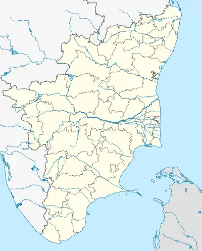 Adamangalam-Pudur Location in Tamil Nadu, India | |
| Coordinates: 12°27′N 79°3′E / 12.450°N 79.050°E | |
| Country | |
| State | Tamil Nadu |
| District | Tiruvannamalai [1] |
| Town panchayat | 1996 |
| Named for | Tamil Name (ஆதமங்கலம் புதூர்) |
| Government | |
| • Type | Town panchayat |
| • Body | pachayat |
| Elevation | 181 m (594 ft) |
| Population (2010) | |
| • Total | 21,000 |
| Languages | |
| • Official | Tamil |
| Time zone | UTC+5:30 (IST) |
| PIN | 606901 |
| Vehicle registration | TN-25 |
| Coastline | 0 kilometres (0 mi) |
| Nearest city | Thiruvannamalai, Polur, Kalasapakkam , Thirupattur |
| Sex ratio | female-994:Male-1000 ♂/♀ |
| Lok Sabha constituency | Thiruvannamalai |
| Vidhan Sabha constituency | Kalasapakkam |
| Avg. summer temperature | 36 °C (97 °F) |
| Avg. winter temperature | 17 °C (63 °F) |
Adamangalam-Pudur is a village panchayat in the foot of Javvadu hill ranges in the Kalasapakkam Taluk of Tiruvannamalai district, Tamil Nadu, India.[1] It has a population of 2100. It is nearly 20 km from the nearby town Polur and 40 km from the district capital. The Famous Manju Virattu is held on pongal once a year. It was arranged by the people of Adamangalam Pudhur and the Agamudaya Thuluva Vellalar community . Thousands of peoples enjoy the Manju Virattu event .
Geography
It is located at 12°25′0″N 79°6′0″E / 12.41667°N 79.10000°E at an elevation of 181 m above MSL.[2]
References
- 1 2 Unknown (listed as Staff Reporter) (18 January 2011). "Tamil Nadu News: Bull race held in village near Tiruvannamalai". The Hindu. Archived from the original on 22 January 2011. Retrieved 15 January 2012.
- ↑ Map and weather of Kalasapakkam
External links
This article is issued from Wikipedia. The text is licensed under Creative Commons - Attribution - Sharealike. Additional terms may apply for the media files.