40°14′00″N 44°15′05″E / 40.23333°N 44.25139°E
Aghavnatun Աղավնատուն | |
|---|---|
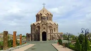 St. Anna Church in Aghavnatun | |
 Aghavnatun Աղավնատուն | |
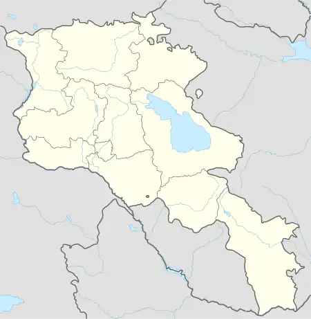
| Coordinates: 40°14′00″N 44°15′05″E / 40.23333°N 44.25139°E | |
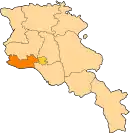
| Country | Armenia |
| Province | Armavir |
| Area | |
| • Total | 11.46 km2 (4.42 sq mi) |
| Elevation | 925 m (3,035 ft) |
| Population (2008) | |
| • Total | 3,164 |
| • Density | 280/km2 (720/sq mi) |
Aghavnatun (Armenian: Աղավնատուն, formerly, Akhavnatukh) is a village in the Armavir Province of Armenia. it is home to ruins of an iron-age fortress, a 13th-century tomb and a chapel.
There are four churches in the village, the oldest of which is Surp Gevork Church of the 10th century. A circular tower of an unknown purpose is found on a hill top near the village. [1]
Gallery
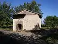 The small church of Karmravor hidden amongst the woods
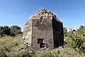 Muslim mausoleum in Aghavnatun
See also
References
- ↑ "Aghavnatun (Armavir)". CAA: Union of Communities of Armenia. Archived from the original on May 30, 2015. Retrieved May 29, 2015.
This article is issued from Wikipedia. The text is licensed under Creative Commons - Attribution - Sharealike. Additional terms may apply for the media files.