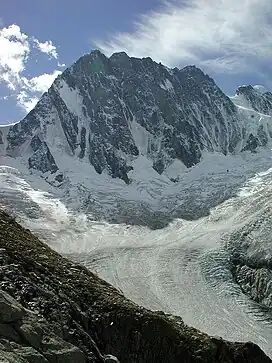
| Aiguille du Plan, 2006 | |
|---|---|
 The Aiguille du Plan | |
| Highest point | |
| Elevation | 3,673 m (12,051 ft)[1] |
| Listing | Mountains of France |
| Coordinates | 45°53′30″N 06°54′26″E / 45.89167°N 6.90722°E |
| Geography | |
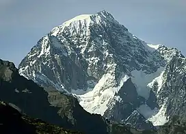
 Aiguille du Plan, 2006 France | |
| Location | Haute-Savoie, Rhône-Alpes, France |
| Parent range | Mont Blanc massif |
| Geology | |
| Mountain type | Granite |
| Climbing | |
| First ascent | July 1871 by James Eccles with Alphonse and Michel Payot |
| Easiest route | Midi-Plan traverse, PD/PD+. |
The Aiguille du Plan (3,673 m) is a mountain in the Mont Blanc massif in the French Alps. Its needle-like summit lies in the centre of the Chamonix Aiguilles when viewed from Chamonix.
References
- ↑ "Topographic map of Aiguille du Plan". opentopomap.org. Retrieved 2023-05-22.
External links

This article is issued from Wikipedia. The text is licensed under Creative Commons - Attribution - Sharealike. Additional terms may apply for the media files.