Al-Bab Subdistrict
ناحية مركز الباب | |
|---|---|
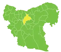 Location of Al-Bab Subdistrict within Aleppo Governorate | |
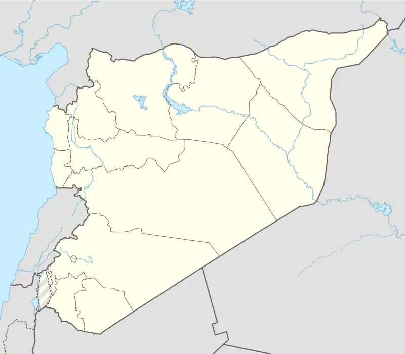 Al-Bab Subdistrict Location in Syria | |
| Coordinates (al-Bab): 36°24′11″N 37°27′38″E / 36.4031°N 37.4606°E | |
| Country | |
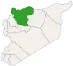
| Governorate | Aleppo |
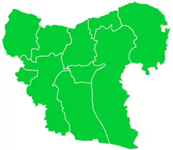
| District | al-Bab |
| Seat | al-Bab |
| Area | |
| • Total | 489.28 km2 (188.91 sq mi) |
| Population (2004)[1] | 112,219 |
| Geocode | SY020200 |
Al-Bab Subdistrict, also called Nahiya Markaz al-Bab (Arabic: ناحية مركز الباب), is a subdistrict of al-Bab District in northern Aleppo Governorate, northwestern Syria. Administrative centre is al-Bab. At the 2004 census, the subdistrict had a population of 112,219.[1]
Cities, towns and villages
| PCode | Name | Population |
|---|---|---|
| C1202 | al-Bab | 63,069 |
| C1188 | Bizaah | 12,718 |
| C1209 | Qabasin | 11,382 |
| C1210 | Maran | 3,670 |
| C1205 | Tell Rahal | 2,866 |
| C1191 | Hezwan | 1,579 |
| C1193 | Maqri | 1,468 |
| C1187 | Sosyan | 1,452 |
| C1200 | Saflaniyeh | 1,353 |
| C1214 | Qubbet Elsheikh | 1,274 |
| C1194 | Aabad | 1,213 |
| C1197 | Suran | 1,041 |
| C1190 | Su Sinbat | 939 |
| C1211 | Qdeiran | 850 |
| C1206 | Shdud | 772 |
| C1189 | Shaala | 757 |
| C1198 | Hadath | 751 |
| C1204 | Olan | 689 |
| C1199 | Tal Jerji | 689 |
| C1213 | Noman | 657 |
| C1196 | Sheikh Elwan | 557 |
| C1195 | Sheikh Jarrah | 535 |
| C1207 | Sheikh Kif | 432 |
| C1186 | Nayrabiyeh | 416 |
| C1208 | Qemmet Daghelbash | 304 |
| C1203 | Big Sarja | 237 |
| C1192 | Borj | 236 |
| C1201 | Um Elamad Elbab | 200 |
| C1212 | Waqqah | 113 |
References
- 1 2 "2004 Census Data for Nahiya al-Bab" (in Arabic). Syrian Central Bureau of Statistics. Archived from the original on 16 May 2017. Retrieved 15 October 2015. Also available in English: "2004 Census Data". UN OCHA. Retrieved 15 October 2015.
Capital: Aleppo | ||||||||||||||||||||
|   | |||||||||||||||||||
|
| ||||||||||||||||||||
| ||||||||||||||||||||
| ||||||||||||||||||||
| ||||||||||||||||||||
| ||||||||||||||||||||
| ||||||||||||||||||||
| ||||||||||||||||||||
| ||||||||||||||||||||
This article is issued from Wikipedia. The text is licensed under Creative Commons - Attribution - Sharealike. Additional terms may apply for the media files.