Alma | |
|---|---|
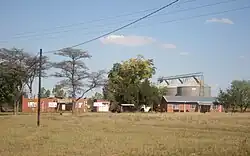 Houses and grain silo in Alma | |
 Alma  Alma | |
| Coordinates: 24°29′20″S 28°04′16″E / 24.489°S 28.071°E | |
| Country | South Africa |
| Province | Limpopo |
| District | Waterberg |
| Municipality | Modimolle–Mookgophong |
| Area | |
| • Total | 0.82 km2 (0.32 sq mi) |
| Population (2011)[1] | |
| • Total | 1,553 |
| • Density | 1,900/km2 (4,900/sq mi) |
| Racial makeup (2011) | |
| • Black African | 99.8% |
| • Coloured | 0.1% |
| • Indian/Asian | 0.1% |
| • White | 0.1% |
| First languages (2011) | |
| • Northern Sotho | 65.7% |
| • Tsonga | 21.5% |
| • Tswana | 3.2% |
| • Sotho | 2.3% |
| • Other | 7.3% |
| Time zone | UTC+2 (SAST) |
| PO box | 0512 |
| Area code | 014 |
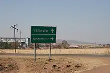
Alma is a small town situated south of Vaalwater in the Limpopo province of South Africa. The area is surrounded by green-gray bushveld vegetation and a few private game reserves are located in the malaria free area.
The Mokolo River originates near Alma at the confluence of the Sand River with the Grootspruit River in a flattish, open area with numerous koppies, before it flows through a steep gorge emerging above the town of Vaalwater. The town is served by Laerskool Alma, a primary and early secondary school situated 24 kilometres (15 mi) from Vaalwater.
Nearby towns
- Warmbaths (now known as Bela Bela)
- Lephalale/Ellisras
- Modimolle/Nylstroom
- Naboomspruit
- Thabazimbi
- Vaalwater
References
- 1 2 3 4 "Main Place Alma". Census 2011.
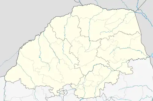
Municipalities and communities of Waterberg District Municipality, Limpopo | ||
|---|---|---|
District seat: Nylstroom (Modimolle) | ||
| Thabazimbi | .svg.png.webp) Waterberg District within South Africa | |
| Lephalale |
| |
| Modimolle–Mookgophong |
| |
| Bela-Bela |
| |
| Mogalakwena |
| |
This article is issued from Wikipedia. The text is licensed under Creative Commons - Attribution - Sharealike. Additional terms may apply for the media files.