Ambato Ambarimay | |
|---|---|
 Ambato Ambarimay Location in Madagascar | |
| Coordinates: 16°47′S 46°32′E / 16.783°S 46.533°E | |
| Country | |
| Region | Boeny |
| District | Ambato-Boeni |
| Area | |
| • Total | 596.60 km2 (230.35 sq mi) |
| Elevation | 60 m (200 ft) |
| Population (2001)[3] | |
| • Total | 35,000 |
| Time zone | UTC3 (EAT) |
| Postal code | 403 |
Ambato Ambarimay (also called: Ambato Boeny) is a rural municipality in Madagascar.[4] It belongs to the district of Ambato-Boeni, which is a part of Boeny Region. The population of the commune was estimated to be approximately 35,000 in 2001 commune census.[3]
In addition to primary schooling the town offers secondary education at both junior and senior levels. The town has a permanent court and hospital. The majority 65% of the population of the commune are farmers, while an additional 10% receives their livelihood from raising livestock. The most important crop is peanuts, while other important products are cotton, rice and cowpeas. Services provide employment for 10% of the population. Additionally fishing employs 15% of the population.[3]
Roads
Ambato Ambarimay is located at the end of the National road 33b from Andranofasika, in a distance of 143 km from Mahajanga.[5]
River
It is situated at the Betsiboka River.
References
- ↑ SAC Ambato Ambarimay
- ↑ Estimated based on DEM data from Shuttle Radar Topography Mission
- 1 2 3 "ILO census data". Cornell University. 2002. Retrieved 2008-03-02.
- ↑ "Ambato Ambarimay Map on Latitude".
- ↑ SAC Ambato Ambarimay
Capital: Mahajanga | ||
| Ambato-Boeni (11) (403) | 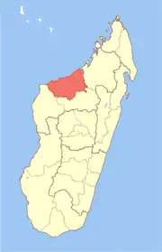 | |
| Mahajanga (1) | ||
| Mahajanga II (9) (402) | ||
| Marovoay (12) (416) | ||
| Mitsinjo (7) (417) | ||
| Soalala (3) (420) | ||
6 districts; 43 communes | ||
16°47′S 46°32′E / 16.783°S 46.533°E