Ambatoharanana | |
|---|---|
 Ambatoharanana Location in Madagascar | |
| Coordinates: 17°19′S 49°17′E / 17.317°S 49.283°E | |
| Country | |
| Region | Analanjirofo |
| District | Fenerive Est |
| Area | |
| • Total | 95 km2 (37 sq mi) |
| Elevation | 140 m (460 ft) |
| Population (2001)[3] | |
| • Total | 6,000 |
| • Ethnicities | Betsimisaraka |
| Time zone | UTC3 (EAT) |
| Postal code | 509 |
Ambatoharanana is a rural municipality in Madagascar. It belongs to the district of Fenerive Est, which is a part of Analanjirofo region. The population of the commune was estimated to be approximately 6,000 in 2001 commune census.[3]
Only primary schooling is available. The majority 82% of the population of the commune are farmers. The most important crop is cloves, while other important products are coffee and rice. Services provide employment for 18% of the population.[3]
Roads
This municipality is linked by the Provincial road 13 to the National road 5.
References
- ↑ Dynamique plantations de giroflier
- ↑ Estimated based on DEM data from Shuttle Radar Topography Mission
- 1 2 3 "ILO census data". Cornell University. 2002. Retrieved 2008-03-07.
Capital: Fenoarivo Atsinanana | ||
| Fenerive Est (509) | 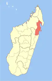 | |
| Mananara Nord (511) | ||
| Maroantsetra (512) | ||
| Sainte Marie (Nosy Boraha) (515) | ||
| Soanierana Ivongo (516) | ||
| Vavatenina (518) | ||
6 districts; 71 communes | ||
17°19′S 49°17′E / 17.317°S 49.283°E
This article is issued from Wikipedia. The text is licensed under Creative Commons - Attribution - Sharealike. Additional terms may apply for the media files.