Amieva | |
|---|---|
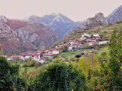 View of Sames, the capital of this municipality. | |
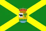 Flag 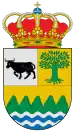 Coat of arms | |
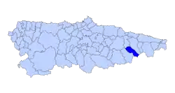 | |
 Amieva Location in Spain | |
| Coordinates: 43°14′N 5°4′W / 43.233°N 5.067°W | |
| Country | |
| Autonomous community | |
| Province | Asturias |
| Comarca | Oriente |
| Capital | Sames |
| Government | |
| • Alcalde | José Félix Fernández Fernández (Asturias Forum) |
| Area | |
| • Total | 113.90 km2 (43.98 sq mi) |
| Highest elevation | 2,478 m (8,130 ft) |
| Population (2018)[1] | |
| • Total | 675 |
| • Density | 5.9/km2 (15/sq mi) |
| Demonym | amievense |
| Time zone | UTC+1 (CET) |
| • Summer (DST) | UTC+2 (CEST) |
| Postal code | 33556 a 33558 |
Amieva is a municipality in the autonomous community of Asturias, Spain. It is also the name of one of the municipality's subdivisions (parroquias, or parish).
Amieva municipality is sparsely inhabited, having a resident population of 868 (2005) and a population density of fewer than 8 people per square kilometre. The total area covers some 114 km2.
History
Coat of arms
Old arms
- Top: Emblem of Pelayo
- Bottom: Two emblems of important families of the City
New arms
Since 30 August 2001.
- Top left > Represents agriculture
- Top right > Represents the Forest economy
- Bottom > Represents the Rio Sella and the Picos de Europa, the most important natural features.
Politics
Local elections | ||||||||||
| Party | 1979 | 1983 | 1987[2] | 1991[2] | 1995[2] | 1999[2] | 2003[2] | 2007[2] | 2011[3] | 2015 |
| FAC | 3 | 4 | ||||||||
| PSOE | 4 | 4 | 4 | 3 | 3 | 4 | 5 | 4 | 3 | 2 |
| CD / AP / PP | 2 | 3 | 4 | 3 | 4 | 1 | 2 | 3 | 1 | 1 |
| PCE / IU-BA | 0 | 1 | 0 | 0 | 0 | 0 | 0 | 0 | ||
| PAS-UNA | 0 | 2 | 2 | 1 | 0 | |||||
| UCD / CDS | 5 | 2 | 1 | 0 | ||||||
| URAS | 1 | |||||||||
| Total | 11 | 9 | 9 | 9 | 9 | 7 | 7 | 7 | 7 | 7 |
Parishes
Amieva is divided into 5 parishes:
Demography
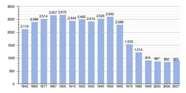 |
Instituto Nacional de Estadística de España - grafics for Wikipedia |
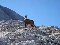
Rebeco in the Picos de Europa.
References
- ↑ Municipal Register of Spain 2018. National Statistics Institute.
- 1 2 3 4 5 6 Dirección General de Política Interior
- ↑ Elecciones Locales 2011
- Population data INE
- Postal codes
- Altitdude Google Earth
External links
- Amieva Digital
- Council of Amieva
- Amieva y Alto Sella
- Rural village in Amieva; rental rooms
- Amieva Full Rental House
This article is issued from Wikipedia. The text is licensed under Creative Commons - Attribution - Sharealike. Additional terms may apply for the media files.