Antalieptė | |
|---|---|
Town | |
 | |
 Flag  Coat of arms | |
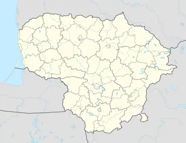 Antalieptė Location of Antalieptė, Lithuania | |
| Coordinates: 55°39′40″N 25°52′01″E / 55.66111°N 25.86694°E | |
| Country | Lithuania |
| Ethnographic region | Aukštaitija |
| Town | |
| Municipality | Zarasai district municipality |
| First mentioned | 1897 |
| Population (2011) | |
| • Total | 278 |
| Time zone | UTC+2 (EET) |
| • Summer (DST) | UTC+3 (EEST) |
| Website | http://www.antaliepte.lt |
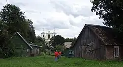
Antalieptė ([anˈtaːlʲɛpteː]) (Polish: Antolepty) is a small town in Zarasai district municipality, near the Duseta–Daugailiai road and the right bank of the Šventoji riverhead. The town is also 4 km from the village of Zabičiūnai.
Antalieptė has a secondary school and post office (postode: LT-32013). In Šventoji valley there is the Antalieptė Cross Discovery church, also there was Antalieptė Discalced Carmelites monastery. Antalieptė also has House of Culture, library (from 1941) and a water mill (built 1855 from broken and round rocks, red bricks and lime; mill was working until 1966).
History
According to the 1897 census, 85.5% of the population of the town was Jewish. The Jews immigrated before World War II or were murdered during the Holocaust in Nazi occupied Lithuania by both Germans and Lithuanians.[1][2]
References
- ↑ "History | Virtual Shtetl". Archived from the original on 24 August 2018. Retrieved 24 August 2018.
- ↑ "АНТОЛЕПТЕ — Российская Еврейская Энциклопедия". rujen.ru. Retrieved 18 March 2023.
| Municipalities |  | |
|---|---|---|
| Cities | ||
| Towns | ||
| Villages | ||