Antsahabe | |
|---|---|
 Antsahabe Location in Madagascar | |
| Coordinates: 14°48′S 48°23′E / 14.800°S 48.383°E | |
| Country | |
| Region | Sofia |
| District | Antsohihy |
| Elevation | 295 m (968 ft) |
| Population (2001)[2] | |
| • Total | 11,000 |
| Time zone | UTC3 (EAT) |
Antsahabe is a town and commune (Malagasy: kaominina) in Madagascar. It belongs to the district of Antsohihy, which is a part of Sofia Region. The population of the commune was estimated to be approximately 11,000 in 2001 commune census.[2]
Only primary schooling is available. Farming and raising livestock provides employment for 40% and 20% of the working population. The most important crop is rice, while another important product is raffia palm. Services provide employment for 2% of the population. Additionally fishing employs 38% of the population.[2]
References and notes
- ↑ Estimated based on DEM data from Shuttle Radar Topography Mission
- 1 2 3 "ILO census data". Cornell University. 2002. Retrieved 2008-02-29.
Capital: Antsohihy | ||
| Analalava (11) (407) | 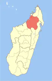 | |
| Antsohihy (12) (407) | ||
| Bealanana (13) (407) | ||
| Befandriana-Nord (12) (409) | ||
| Boriziny (15) (Port-Bergé) (419) |
| |
| Mampikony (6) (414) | ||
| Mandritsara (22) (415) | ||
7 districts; 91 communes | ||
14°48′S 48°23′E / 14.800°S 48.383°E
This article is issued from Wikipedia. The text is licensed under Creative Commons - Attribution - Sharealike. Additional terms may apply for the media files.